

Explore DJI FlightHub 2
Explore our enterprise software platforms built to convert data into measurable, operational intelligence.
DJI FlightHub 2
Cloud Based Drone Operations and Fleet Management
DJI FlightHub 2 is an enterprise cloud platform designed to manage drone operations, teams and mission data from a single interface. Built for remote operations and real time collaboration, it enables organisations to monitor flights, coordinate pilots and analyse aerial data across multiple sites.
By centralising mission planning, live data streaming and operational oversight, FlightHub 2 provides the visibility and control required for scalable enterprise drone deployments.
Product Overview
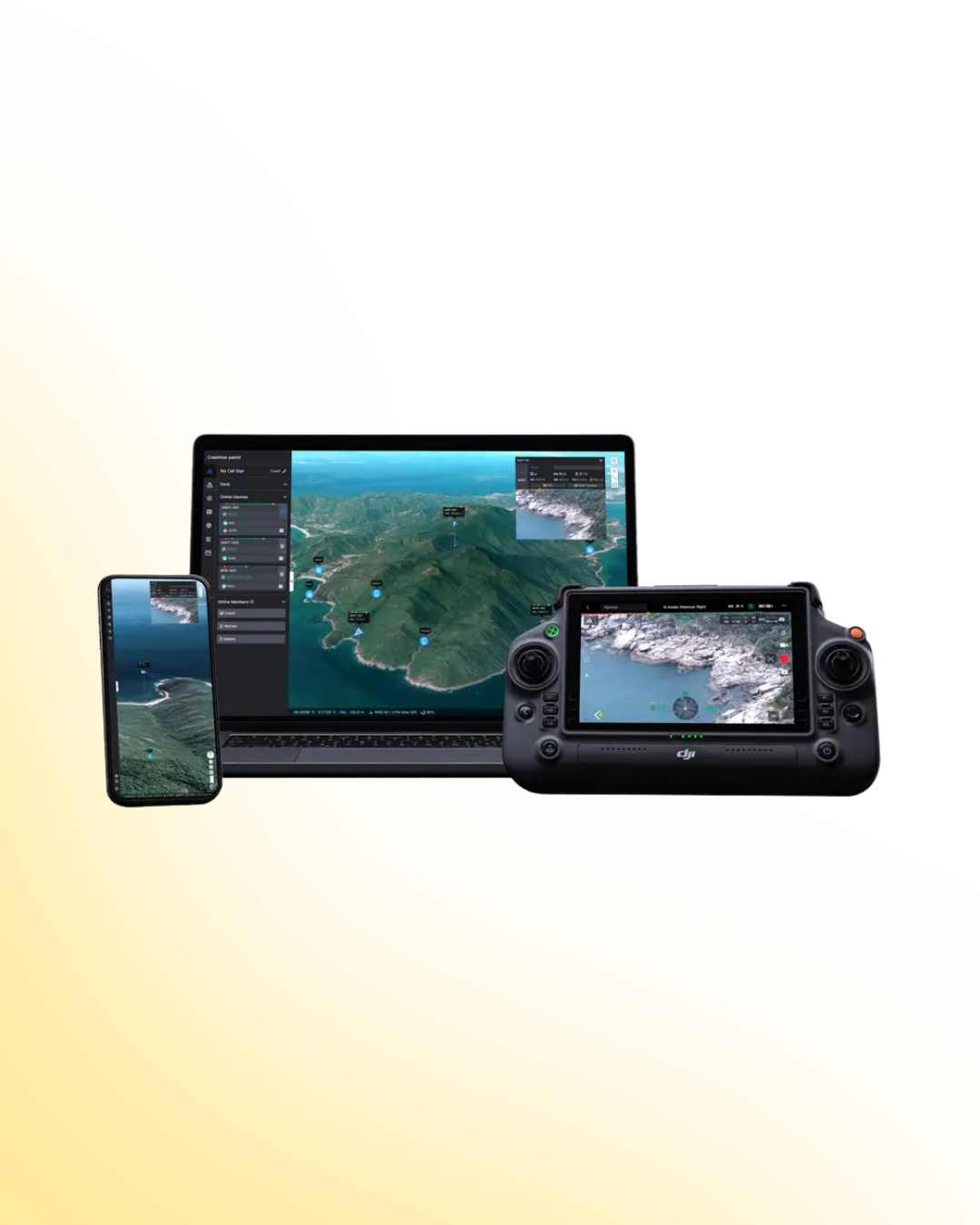
DJI FlightHub 2 provides a unified cloud platform for managing enterprise drone fleets and coordinating aerial operations. From mission planning and real time monitoring to team collaboration and data management, it enables organisations to operate drones more efficiently across distributed locations.
Designed for infrastructure operators, security teams and inspection workflows, FlightHub 2 integrates seamlessly with DJI enterprise drones and DJI Dock systems to enable remote and automated operations.
Remote Drone Operations and Fleet Management
Centralised Control Across Multiple Sites
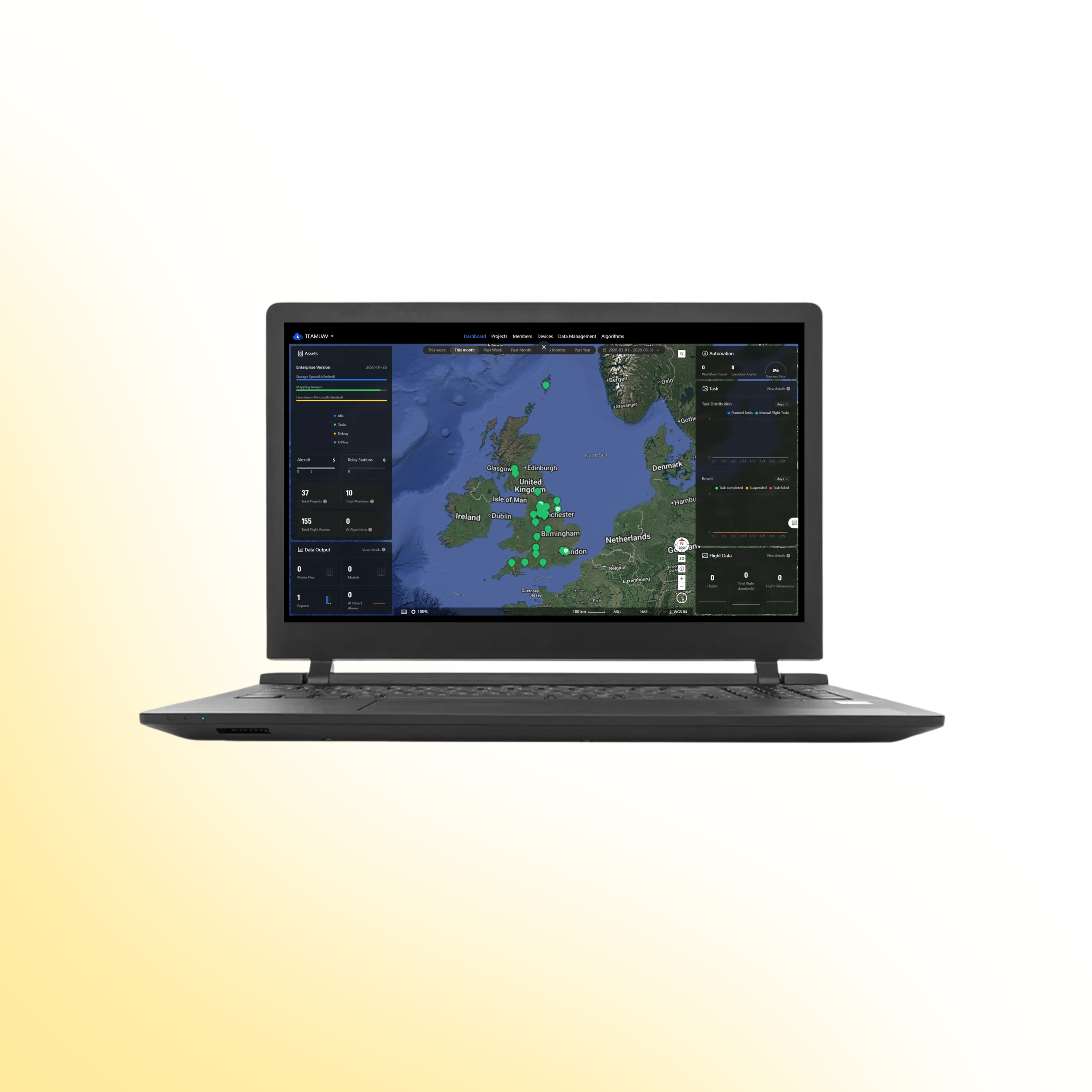
DJI FlightHub 2 enables organisations to manage drone operations from a single cloud based platform, providing full visibility of aircraft, missions and operational data.
Through a centralised dashboard, teams can monitor flights, coordinate pilots and oversee multiple drone deployments simultaneously.
Monitor live drone flights across multiple locations
Manage aircraft, pilots and operational permissions
Plan and schedule missions remotely
Access live video feeds and telemetry data
Maintain operational oversight across distributed teams
This allows organisations to scale drone operations while maintaining consistent control and accountability.
Mission Planning and Real Time Collaboration
Streamlined Workflow and Data Sharing
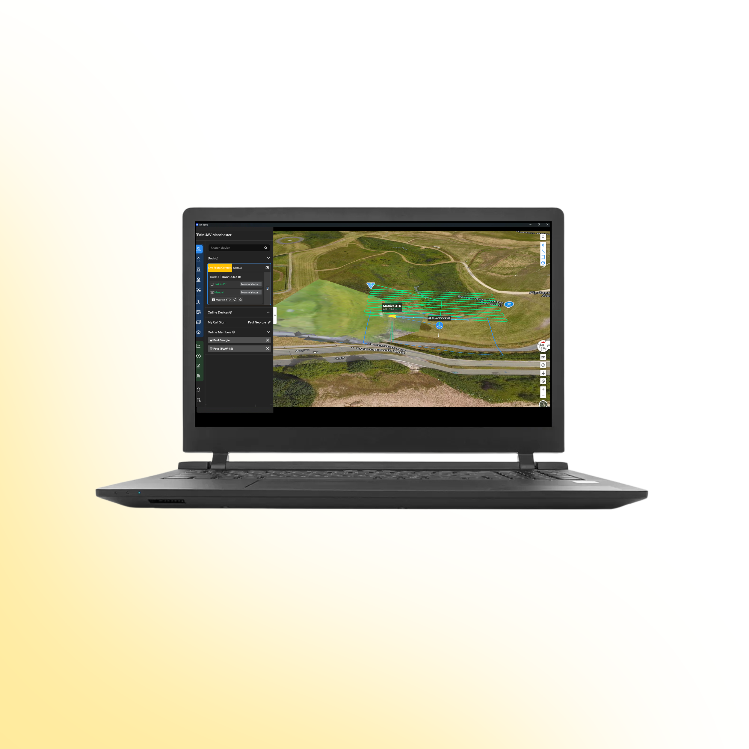
FlightHub 2 enables teams to plan missions, collaborate in real time and access aerial data through a shared cloud environment. This improves situational awareness and allows teams to make informed decisions based on live drone intelligence.
Integrated tools support mission planning, data visualisation and operational coordination.
Plan and manage missions from a cloud based interface
Share live drone feeds with remote teams
Annotate maps and aerial imagery during operations
Coordinate pilots and teams across locations
Store and manage operational data securely
This enables faster decision making and improved collaboration across operational teams.
Drone Systems
Advanced aerial systems engineered to expand operational capability, accuracy and mission performance.
DJI Matrice 400
The DJI Matrice 400 is an advanced enterprise drone platform engineered for complex industrial operations. With extended endurance, heavy payload capacity and intelligent sensing systems, it supports inspection, infrastructure, utilities and mission-critical deployments at scale.
DJI Dock 3
The DJI Dock 3 is an autonomous drone system designed for continuous remote inspection and public safety operations. Integrating automated deployment with Matrice 4D or 4TD aircraft, it delivers reliable aerial oversight in demanding environments.
DJI Matrice 4E
The DJI Matrice 4E is a compact mapping drone built for high-accuracy surveying and geospatial workflows. Featuring a mechanical shutter wide-angle camera and advanced capture modes, it enables efficient orthophoto and 3D data collection across construction, mining and infrastructure projects.
DJI Matrice 4T
The DJI Matrice 4T is a compact multi-sensor drone designed for inspection, public safety and emergency response operations. Combining high-resolution zoom, thermal imaging and a laser rangefinder, it delivers actionable visual and temperature data for complex missions in challenging environments.
Payloads
Advanced sensor solutions designed to expand capability, accuracy and mission performance.
DJI Zenmuse L3
The Zenmuse L3 is a high precision LiDAR payload designed for detailed 3D mapping and terrain modelling. It captures dense point cloud data with integrated RGB support, making it ideal for surveying, corridor mapping and infrastructure inspection in complex environments.
DJI Zenmuse P1
The Zenmuse P1 is a full frame photogrammetry payload built for efficient large scale mapping. With high resolution imaging and a mechanical shutter, it delivers accurate 2D and 3D data for construction, land surveying and infrastructure projects.
DJI Zenmuse H30T
The Zenmuse H30T combines high resolution zoom optics with thermal imaging for inspection and public safety operations. It enables operators to detect anomalies, monitor assets and gather visual and thermal data from a safe distance.
DJI Zenmuse L2
The Zenmuse L2 integrates LiDAR scanning with an RGB mapping camera to deliver high accuracy terrain capture and asset modelling. It produces reliable point cloud and colourised data for surveying, infrastructure inspection and corridor mapping operations.
Software
Advanced software platforms designed to transform drone data into accurate insight and operational intelligence.
DJI Terra
DJI Terra is a professional drone mapping platform designed for processing aerial imagery and LiDAR datasets. Supporting photogrammetry reconstruction and terrain modelling, it converts captured drone data into accurate maps, 3D models and measurable outputs for surveying, construction and infrastructure analysis.
DJI FlightHub 2
DJI FlightHub 2 is a cloud based drone operations platform designed for remote fleet management and mission coordination. Integrating real time data streaming, flight planning and team collaboration, it provides centralised control and operational visibility for enterprise drone deployments.
FAQs
-
DJI FlightHub 2 is a cloud based platform used to manage enterprise drone operations. It allows organisations to plan missions, monitor flights, manage fleets and share real time aerial data across teams and locations.
-
DJI FlightHub 2 is available as a public cloud service and as an on-premises deployment. The platform is offered in Standard, Business and Enterprise tiers depending on operational requirements.
-
DJI FlightHub 2 supports a range of DJI Enterprise platforms including Matrice 400, Matrice 350 RTK, Matrice 30 Series, Matrice 4 Series, Matrice 4D Series and the Mavic 3 Enterprise Series. It also supports DJI Dock systems and compatible Zenmuse payloads.
-
No. DJI FlightHub 2 is designed specifically for DJI Enterprise platforms and does not support drones from other manufacturers.
-
Yes. FlightHub 2 supports automated operational workflows including scheduled missions, automated data analysis and automatic updates of 2D and 3D site models.
-
For users outside mainland China, DJI FlightHub 2 data is stored on Amazon Web Services infrastructure located in the United States or Germany.
-
The web platform supports Windows, macOS, Android and iOS devices. DJI recommends using Google Chrome version 92 or later for the best experience.
-
No. DJI FlightHub 2 uses the DJI Unified Account system, so users can log in with their existing DJI account credentials.
-
Livestream usage is calculated based on total viewing time across the platform. If multiple users watch the same livestream simultaneously, the viewing time is multiplied by the number of viewers.
-
If the Virtual Cockpit page is left open for more than 40 minutes without activity, DJI FlightHub 2 automatically stops the livestream to prevent unintended continuous streaming.
Ready to Upgrade Your Capability?
Speak to our team to discuss pricing, availability and the most suitable configuration for your operational requirements. We can advise on payload selection, regulatory considerations, training and ongoing support to ensure you deploy with confidence.