
Explore our range of drones designed to help you move forward with confidence, wherever you're headed next.
Explore The Matrice 400

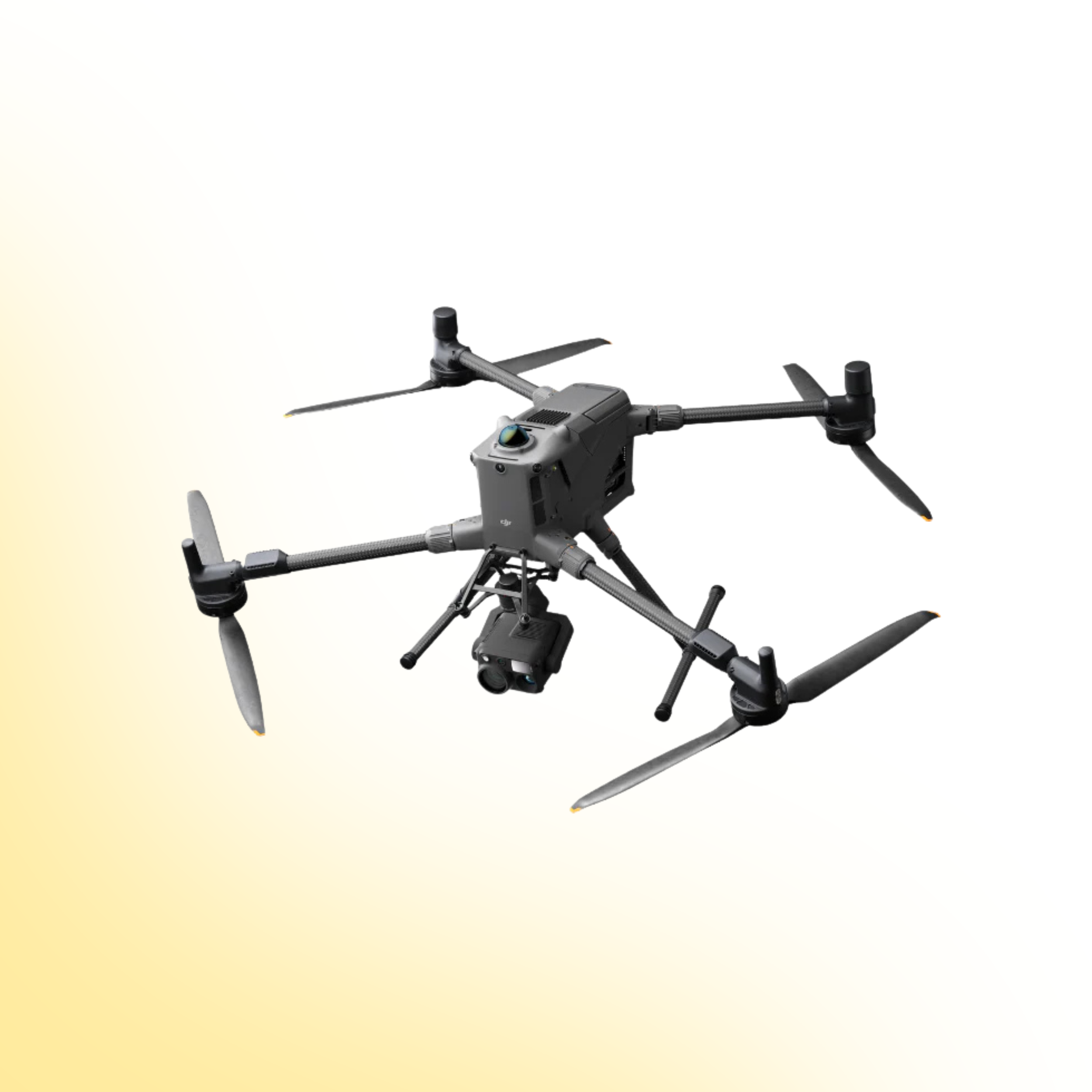
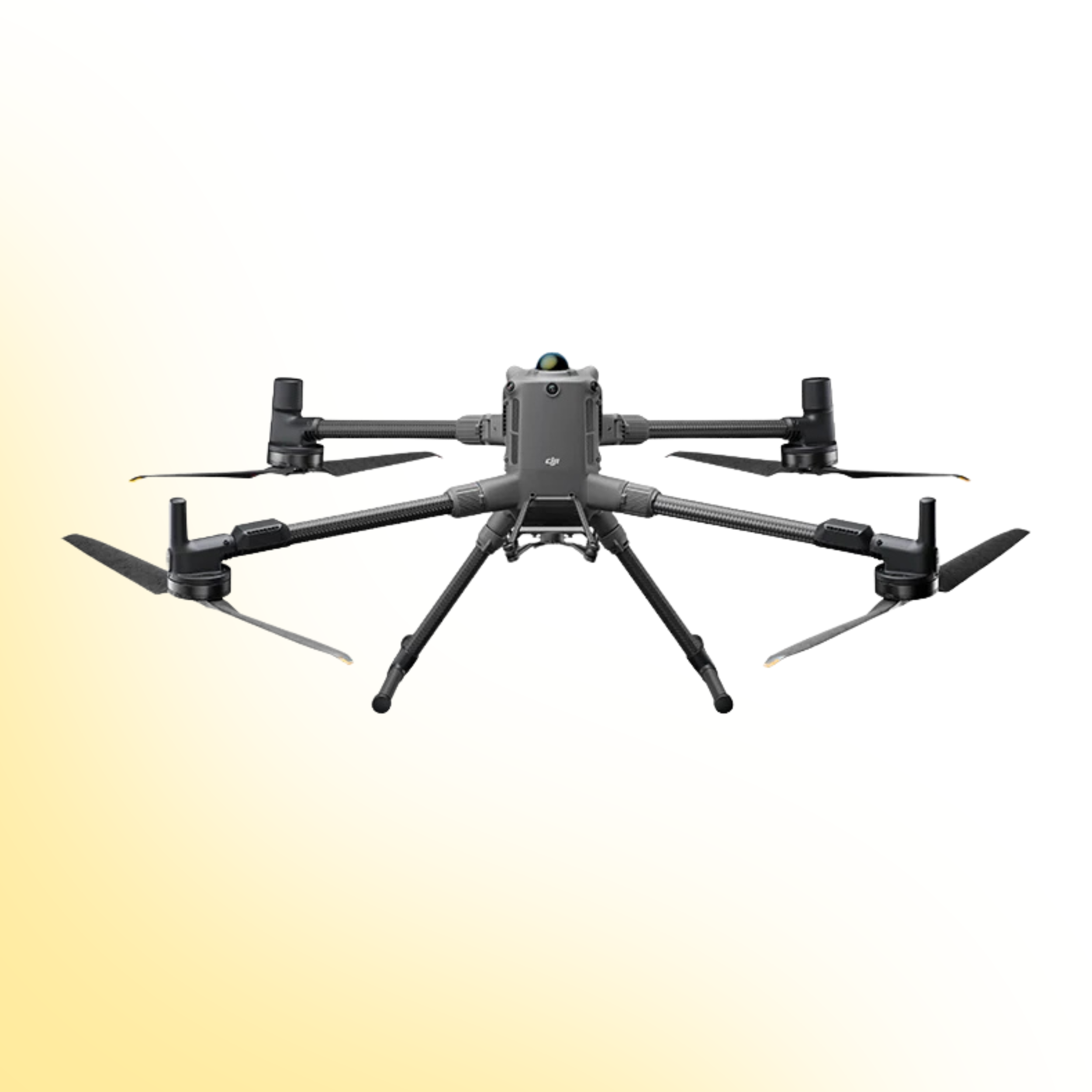
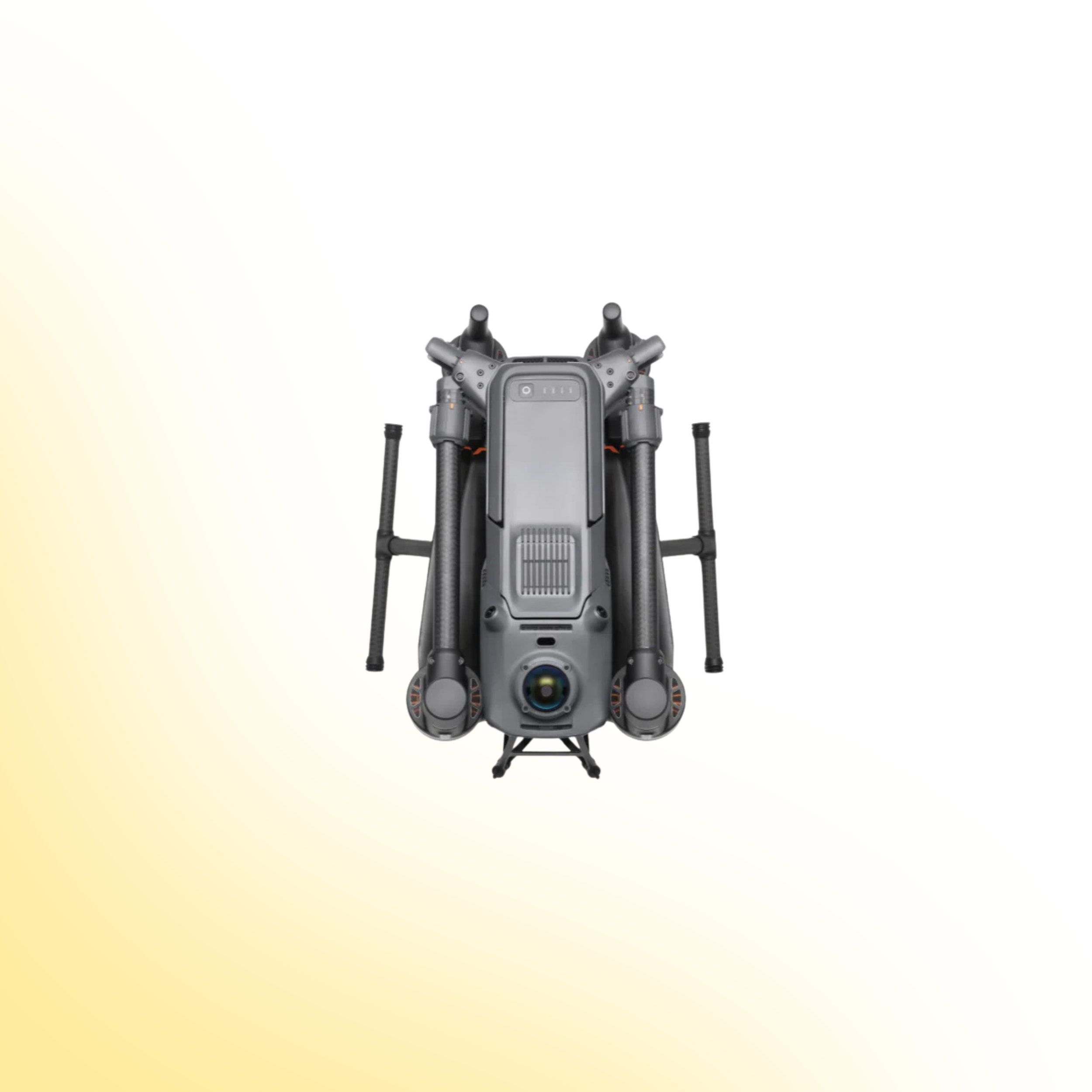
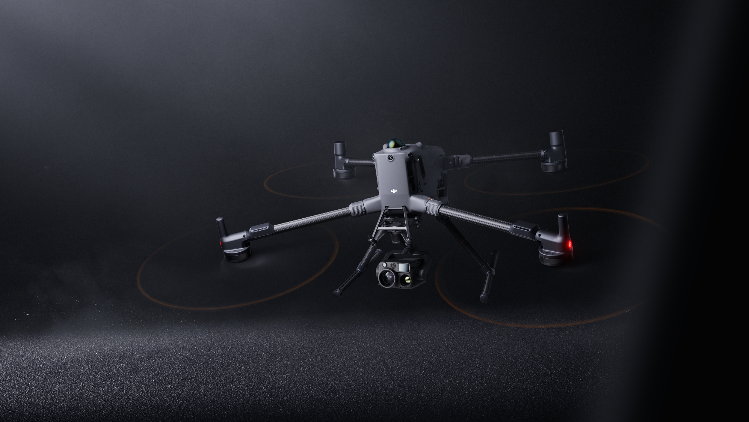
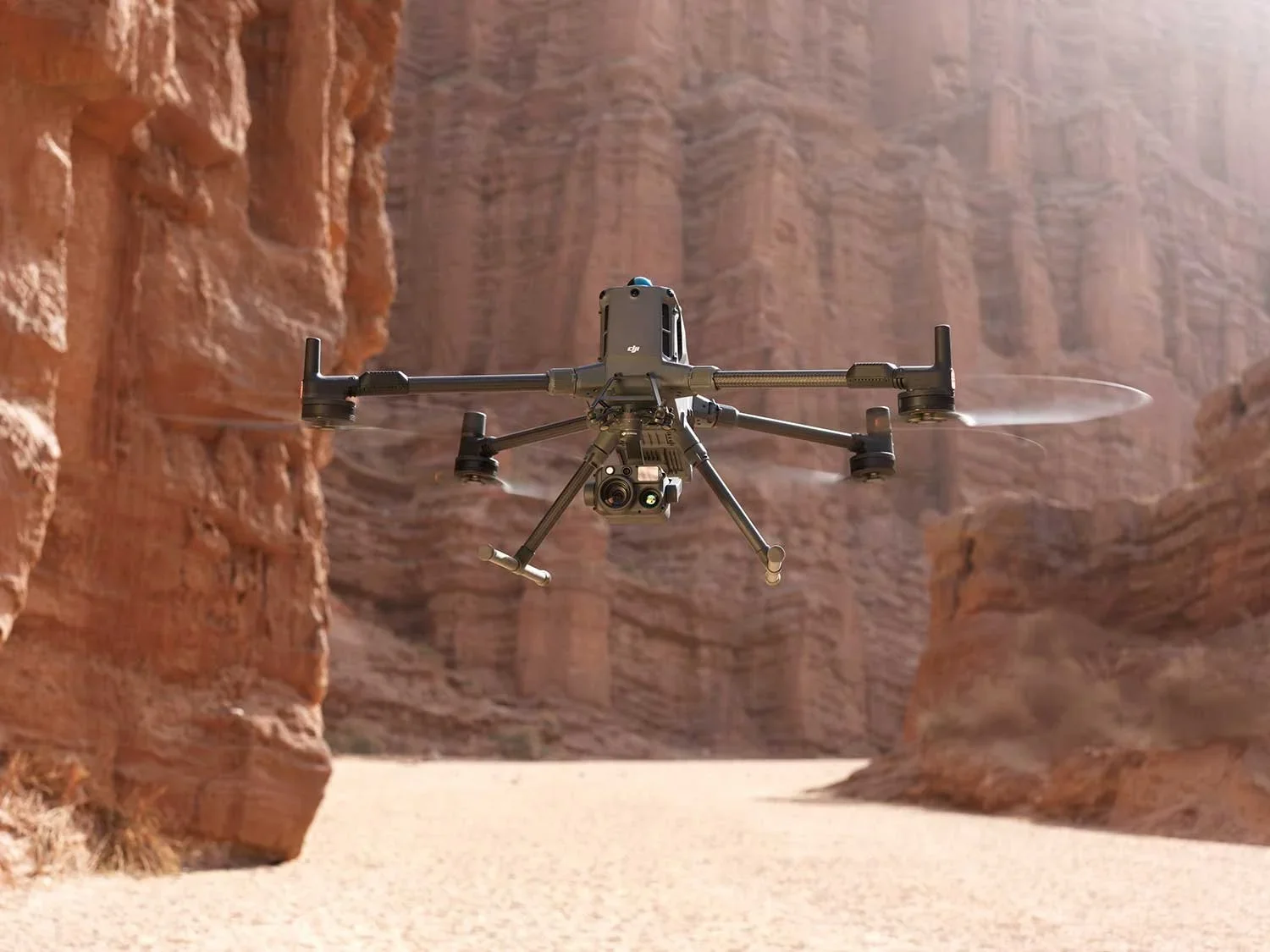
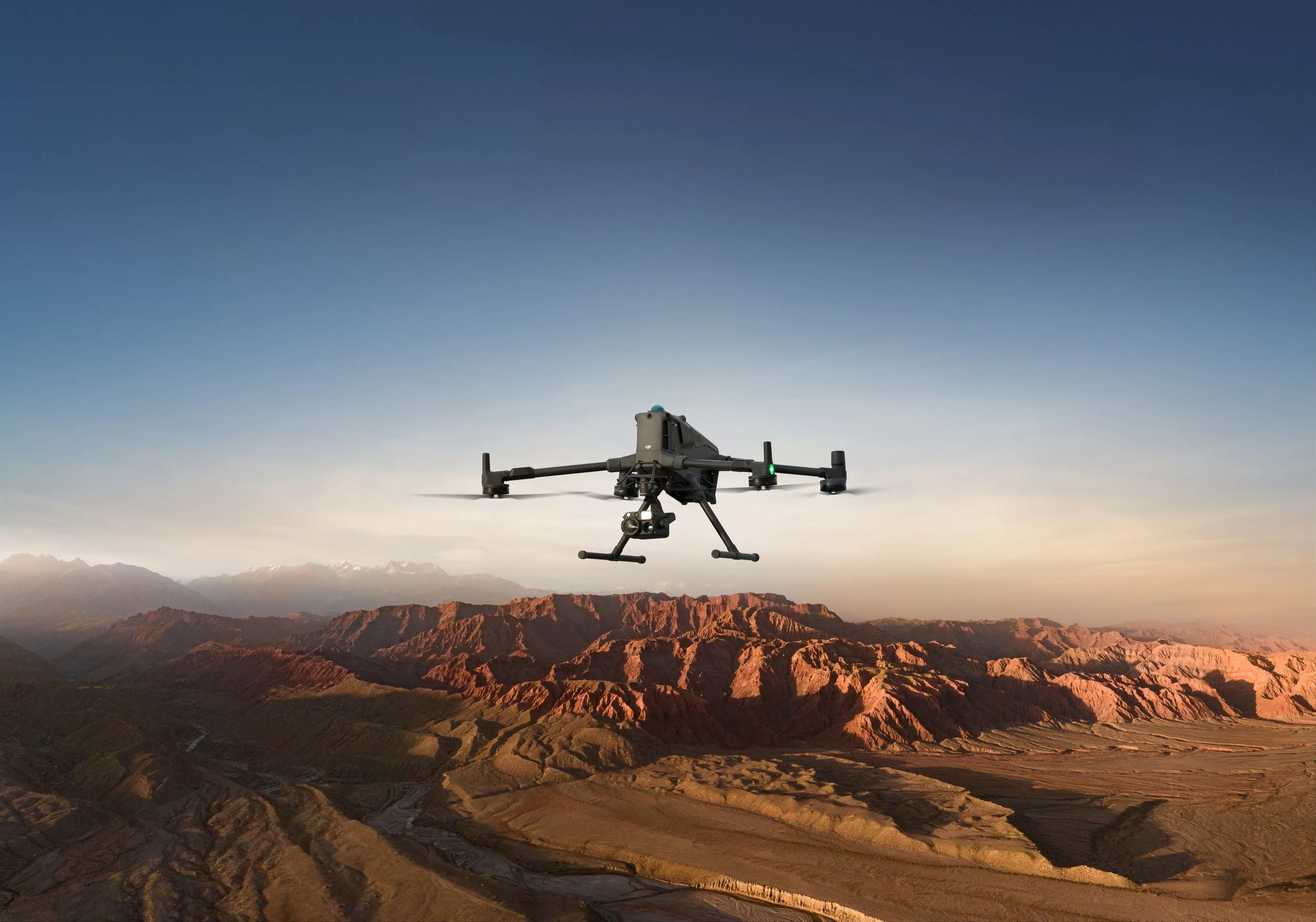
DJI Matrice 400
Enterprise Power. Industrial Precision.
The DJI Matrice 400 sets a new benchmark for enterprise drone operations. Built for demanding industrial environments, it combines advanced obstacle sensing, intelligent automation and multi payload flexibility in a single, highly capable platform.
Engineered for inspection, utilities, public safety, infrastructure and offshore operations, the Matrice 400 delivers the performance, reliability and precision required for critical missions.
Product Overview
The DJI Matrice 400 combines advanced sensing, intelligent automation and flexible payload integration to support complex enterprise missions. Explore the core technologies and capabilities below to understand how it enhances safety, efficiency and operational performance in demanding environments.
A new industry standard for enterprise operations
The DJI Matrice 400 is designed to carry more, see more and automate more. With extended flight time, integrated LiDAR and radar sensing, augmented reality guidance and support for up to seven payloads, it enables safer, smarter and more efficient data capture across complex environments.
From power line inspections and infrastructure surveys to maritime deployment and automated mapping, the Matrice 400 provides the tools required for modern enterprise drone operations.
Enterprise Obstacle Sensing
24/7 intelligent awareness
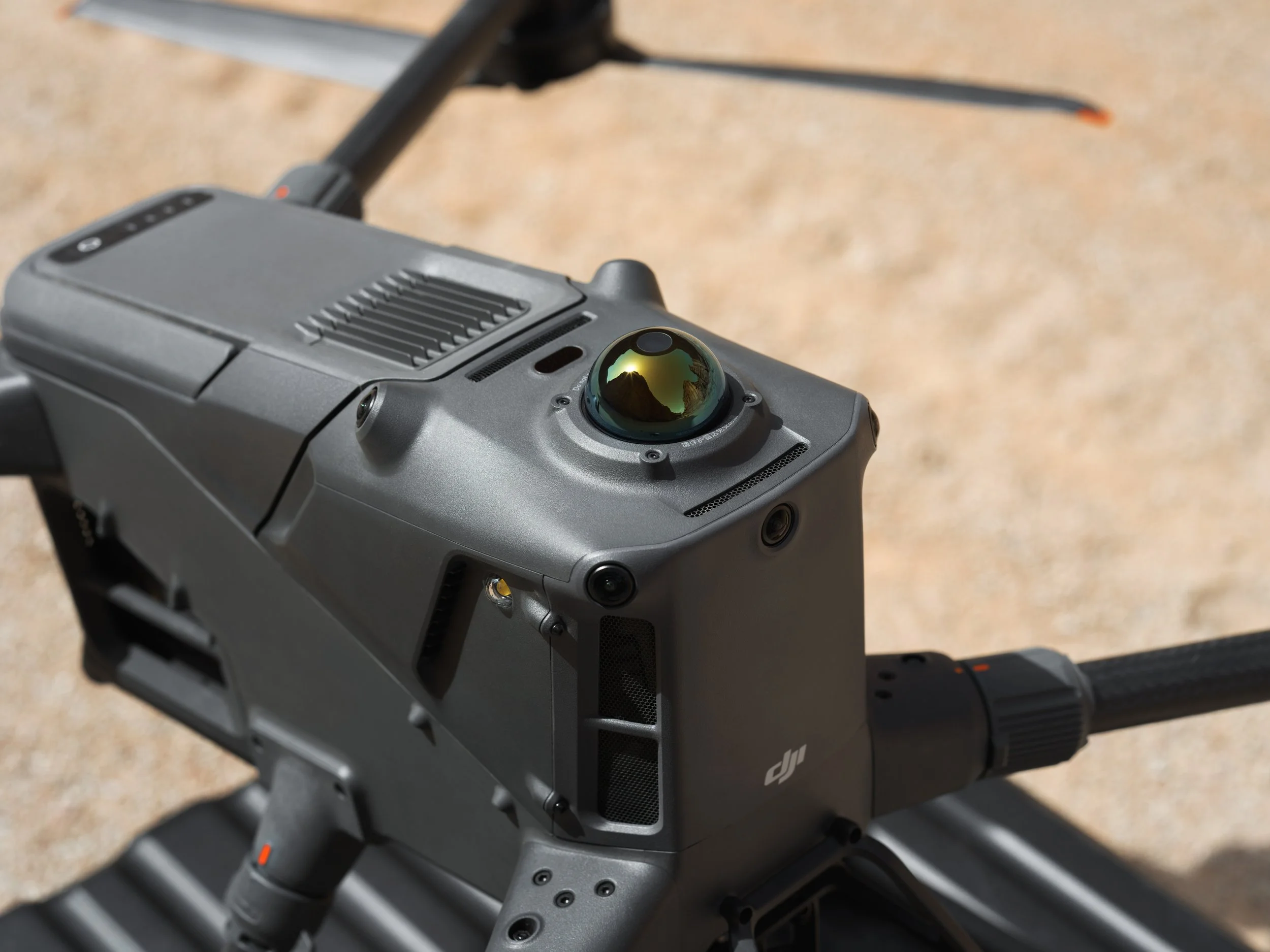
The Matrice 400 features one of the most advanced sensing systems available in an enterprise drone platform, combining LiDAR, Wave radar and full colour vision sensors for precise obstacle detection in all conditions.
Rotating LiDAR provides 360 degree horizontal and 58 degree vertical coverage, detecting small obstacles such as power lines at ranges up to 100 m with high precision modelling capability.
Six directional Wave radar delivers full directional sensing with wide field of view, capable of detecting fine wires and maintaining performance in fog, rain, snow and smoke.
Full colour fisheye vision with four low light sensors captures detailed visual data for accurate object recognition and visual positioning when GNSS is limited.
Integrated sensing enables stable flight in weak signal or GNSS denied environments.
Designed to meet Class 1 eye safety standards.
Multi Payload Flexibility
Carry up to 7 payloads
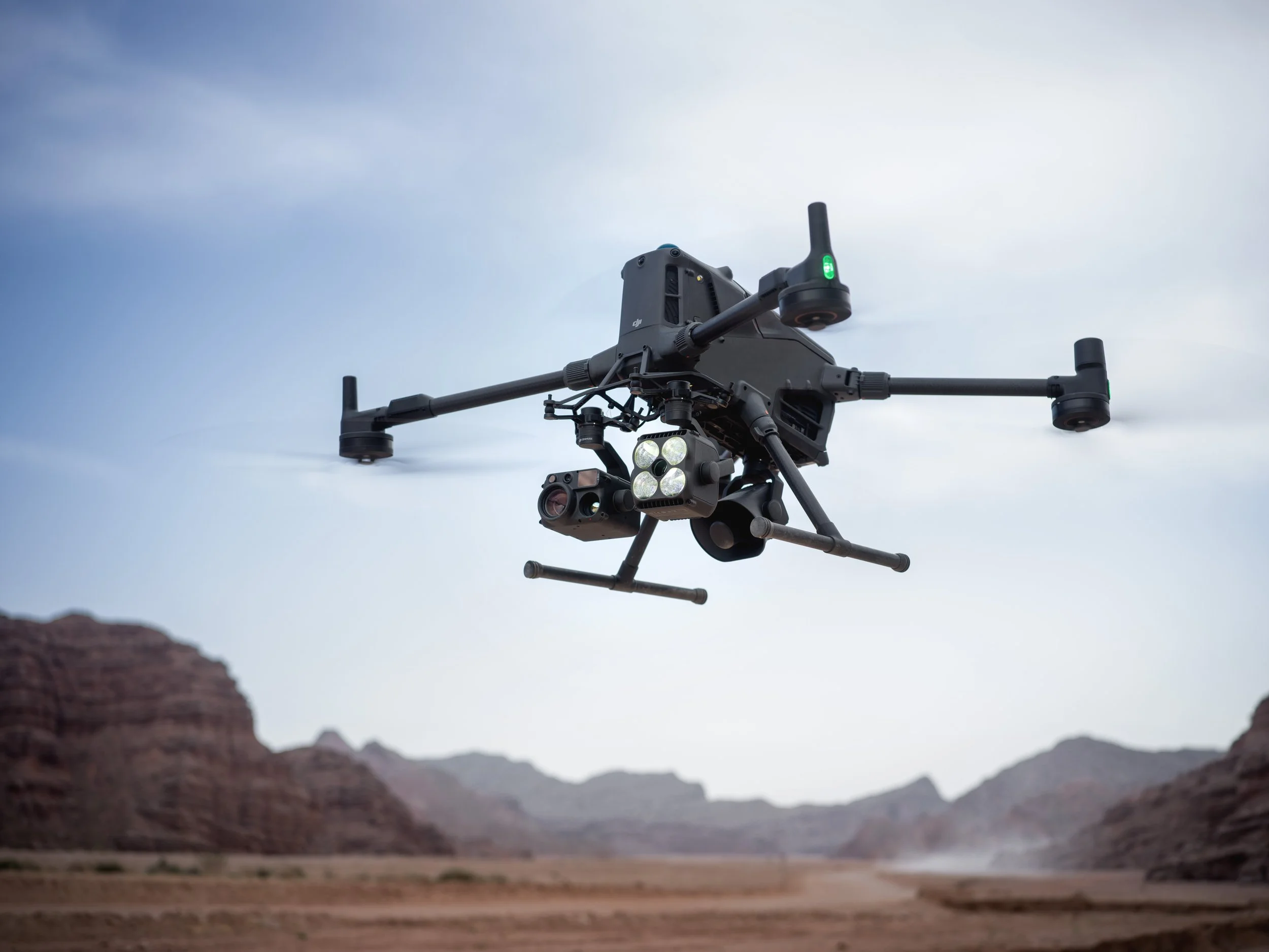
The DJI Matrice 400 is built for modular enterprise operations, allowing multiple sensors to be deployed simultaneously to reduce repeat flights and improve efficiency.
With up to 6 kg payload capacity and support for seven payloads via four E Port V2 interfaces, it enables flexible configurations tailored to mission requirements.
Reduce mission time by eliminating the need to land and swap payloads.
Capture complementary datasets simultaneously, improving inspection accuracy and context.
Configure the aircraft for sector specific use cases including utilities, infrastructure inspection, mapping, security and emergency response.
Future proof operations with expandable interface support for evolving payload technologies.
This level of flexibility allows organisations to standardise on a single enterprise platform rather than operating multiple aircraft for different applications. The result is simplified fleet management, reduced training requirements and improved return on investment.
Augmented Reality and Mission Guidance
Real time awareness for complex operations
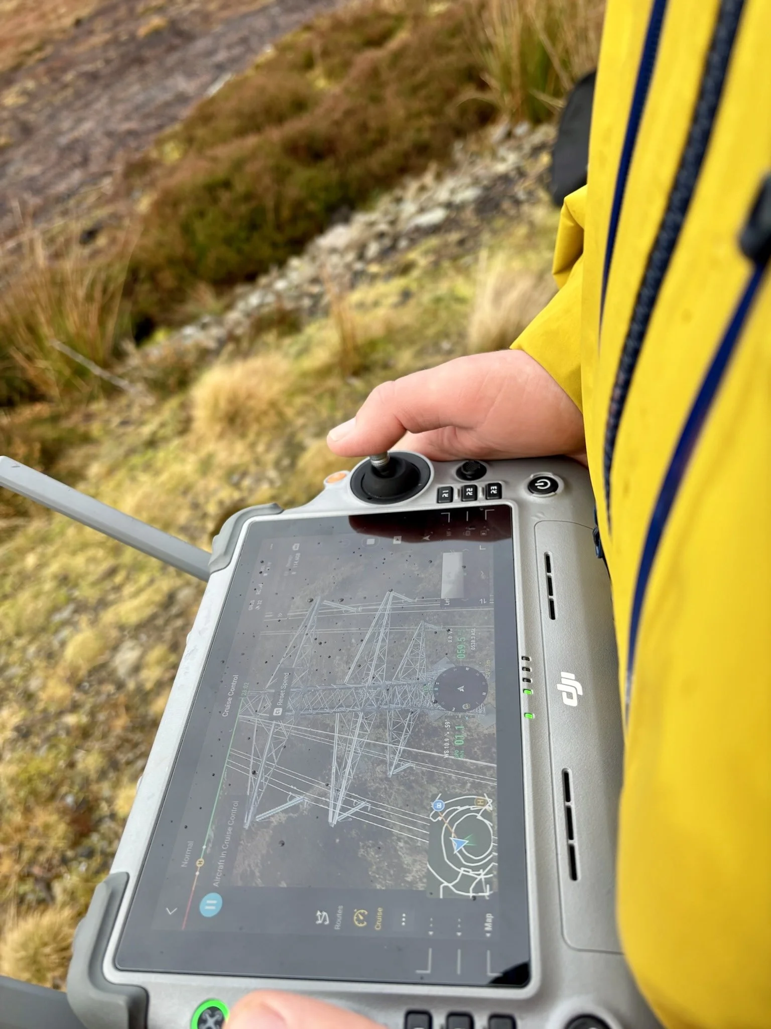
The Matrice 400 integrates augmented reality overlays to improve situational awareness and navigation during live missions.
AR power line display highlights frontal wires during grid inspections.
AR map view displays building names, landmarks and key routes in real time.
AR flight route previews are visible during Return to Home and FlyTo operations.
AR landing shadow assists with precise touch down positioning.
Live annotations allow users to mark locations, draw measurement lines and outline areas without requiring full 3D modelling.
RC signal direction prompts indicate aircraft position relative to the controller if signal weakens.
These tools improve mission clarity, support decision making and enhance safety during time critical or high risk deployments.
Intelligent Automation and Smart Flight
Streamlined missions with advanced flight modes
The Matrice 400 is built to reduce pilot workload and improve repeatability through intelligent automation and advanced mission planning tools.
Cruise mode enables directional flight without constant input.
FlyTo automatically calculates optimal paths and speed adjustments to reach targets efficiently.
Smart Track supports subject tracking with auto zoom and reacquisition.
POI mode allows precise orbiting of targets for inspection and modelling.
Terrain follow maintains consistent altitude for stable data capture and accurate ground sampling distance.
Power Line Follow automates linear inspections using compatible payloads.
Route Automation supports slope based and geometric route planning for repeatable data collection.
Smart 3D Capture generates rough models and capture routes with visual previews.
Observed View displays the camera field of view on the map to reduce search workload.
Fleet Management with DJI FlightHub 2
Centralised control and mission oversight

The Matrice 400 integrates with DJI FlightHub 2 for remote operations and fleet management.
Virtual cockpit for remote piloting.
Remote payload control including compatible sensors.
AI detection alerts delivered in real time.
Waypoint and POI mission management.
Centralised data visibility and operational coordination.
This enables scalable deployment across teams and sites while maintaining oversight and operational control.
Drone Systems
Advanced aerial systems engineered to expand operational capability, accuracy and mission performance.
DJI Matrice 400
The DJI Matrice 400 is an advanced enterprise drone platform engineered for complex industrial operations. With extended endurance, heavy payload capacity and intelligent sensing systems, it supports inspection, infrastructure, utilities and mission-critical deployments at scale.
DJI Dock 3
The DJI Dock 3 is an autonomous drone system designed for continuous remote inspection and public safety operations. Integrating automated deployment with Matrice 4D or 4TD aircraft, it delivers reliable aerial oversight in demanding environments.
DJI Matrice 4E
The DJI Matrice 4E is a compact mapping drone built for high-accuracy surveying and geospatial workflows. Featuring a mechanical shutter wide-angle camera and advanced capture modes, it enables efficient orthophoto and 3D data collection across construction, mining and infrastructure projects.
DJI Matrice 4T
The DJI Matrice 4T is a compact multi-sensor drone designed for inspection, public safety and emergency response operations. Combining high-resolution zoom, thermal imaging and a laser rangefinder, it delivers actionable visual and temperature data for complex missions in challenging environments.
Payloads
Advanced sensor solutions designed to expand capability, accuracy and mission performance.
DJI Zenmuse L3
The Zenmuse L3 is a high precision LiDAR payload designed for detailed 3D mapping and terrain modelling. It captures dense point cloud data with integrated RGB support, making it ideal for surveying, corridor mapping and infrastructure inspection in complex environments.
DJI Zenmuse P1
The Zenmuse P1 is a full frame photogrammetry payload built for efficient large scale mapping. With high resolution imaging and a mechanical shutter, it delivers accurate 2D and 3D data for construction, land surveying and infrastructure projects.
DJI Zenmuse H30T
The Zenmuse H30T combines high resolution zoom optics with thermal imaging for inspection and public safety operations. It enables operators to detect anomalies, monitor assets and gather visual and thermal data from a safe distance.
DJI Zenmuse L2
The Zenmuse L2 integrates LiDAR scanning with an RGB mapping camera to deliver high accuracy terrain capture and asset modelling. It produces reliable point cloud and colourised data for surveying, infrastructure inspection and corridor mapping operations.
Software
Advanced software platforms designed to transform drone data into accurate insight and operational intelligence.
DJI Terra
DJI Terra is a professional drone mapping platform designed for processing aerial imagery and LiDAR datasets. Supporting photogrammetry reconstruction and terrain modelling, it converts captured drone data into accurate maps, 3D models and measurable outputs for surveying, construction and infrastructure analysis.
DJI FlightHub 2
DJI FlightHub 2 is a cloud based drone operations platform designed for remote fleet management and mission coordination. Integrating real time data streaming, flight planning and team collaboration, it provides centralised control and operational visibility for enterprise drone deployments.
FAQs
-
The DJI Matrice 400 delivers up to 59 minutes of flight time, depending on payload and operating conditions, enabling longer inspections and reduced battery changes on site.
-
The Matrice 400 has an IP55 protection rating and supports flight in rainfall conditions of up to 100 mm within 24 hours, making it suitable for challenging environments.
-
It integrates omnidirectional vision sensors, rotating LiDAR and mmWave radar to provide advanced obstacle detection and enhanced situational awareness.
-
The aircraft can detect fine obstacles such as power lines and supports avoidance at speeds of up to 25 m/s under specified conditions.
-
The third gimbal mount supports up to 6 kg payload capacity, with multiple mounting configurations available to suit different mission requirements.
-
The aircraft supports up to seven mounted payloads via four E-Port V2 interfaces, enabling multi-sensor configurations within a single mission.
-
Supported payloads include the Zenmuse H30, H30T, L2 and P1, along with compatible DJI ecosystem accessories.
-
The aircraft holds EASA C3 certification.
-
Yes. The aircraft supports installation of up to two 4G enhanced transmission modules for improved connectivity and signal resilience.
-
Yes, the Matrice 400 is compatible with DJI D-RTK 3 for high precision positioning.
-
Yes. The aircraft is capable of maritime take-off and landing, supporting offshore and vessel-based operations.
-
Yes. The Matrice 400 supports airborne relay and can provide relay support for another Matrice 400 aircraft.
-
Yes. It supports remote control, payload management and mission execution through DJI FlightHub 2.
-
No. Accessories are not cross-compatible between the two platforms.
-
Firmware can be updated via DJI Assistant 2 (Enterprise Series) or through the DJI Pilot 2 app.
Ready to Upgrade Your Capability?
Speak to our team to discuss pricing, availability and the most suitable configuration for your operational requirements. We can advise on payload selection, regulatory considerations, training and ongoing support to ensure you deploy with confidence.