

Explore our range of payloads designed to help you move forward with confidence, wherever you're headed next.
Explore The Zenmuse P1
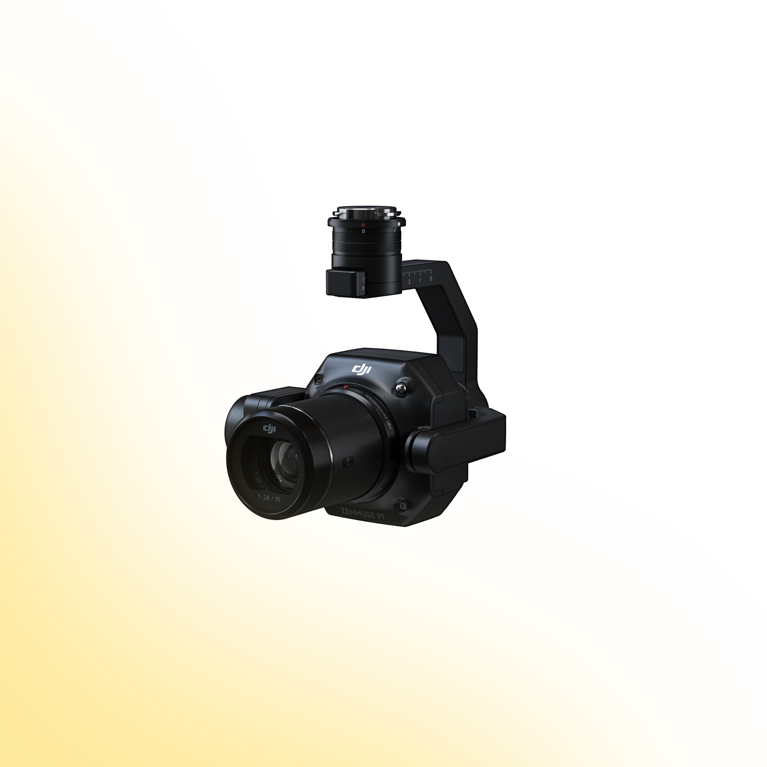
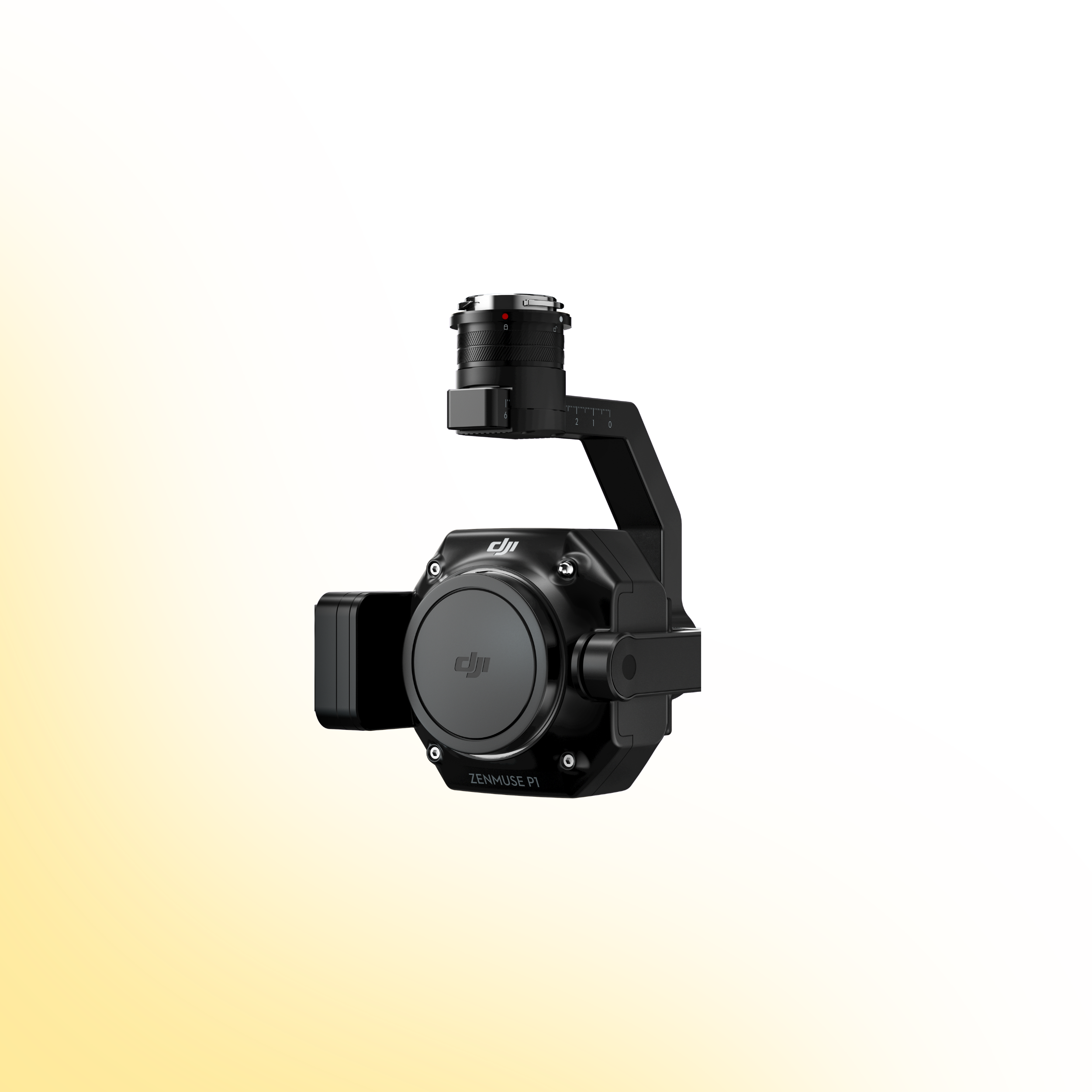
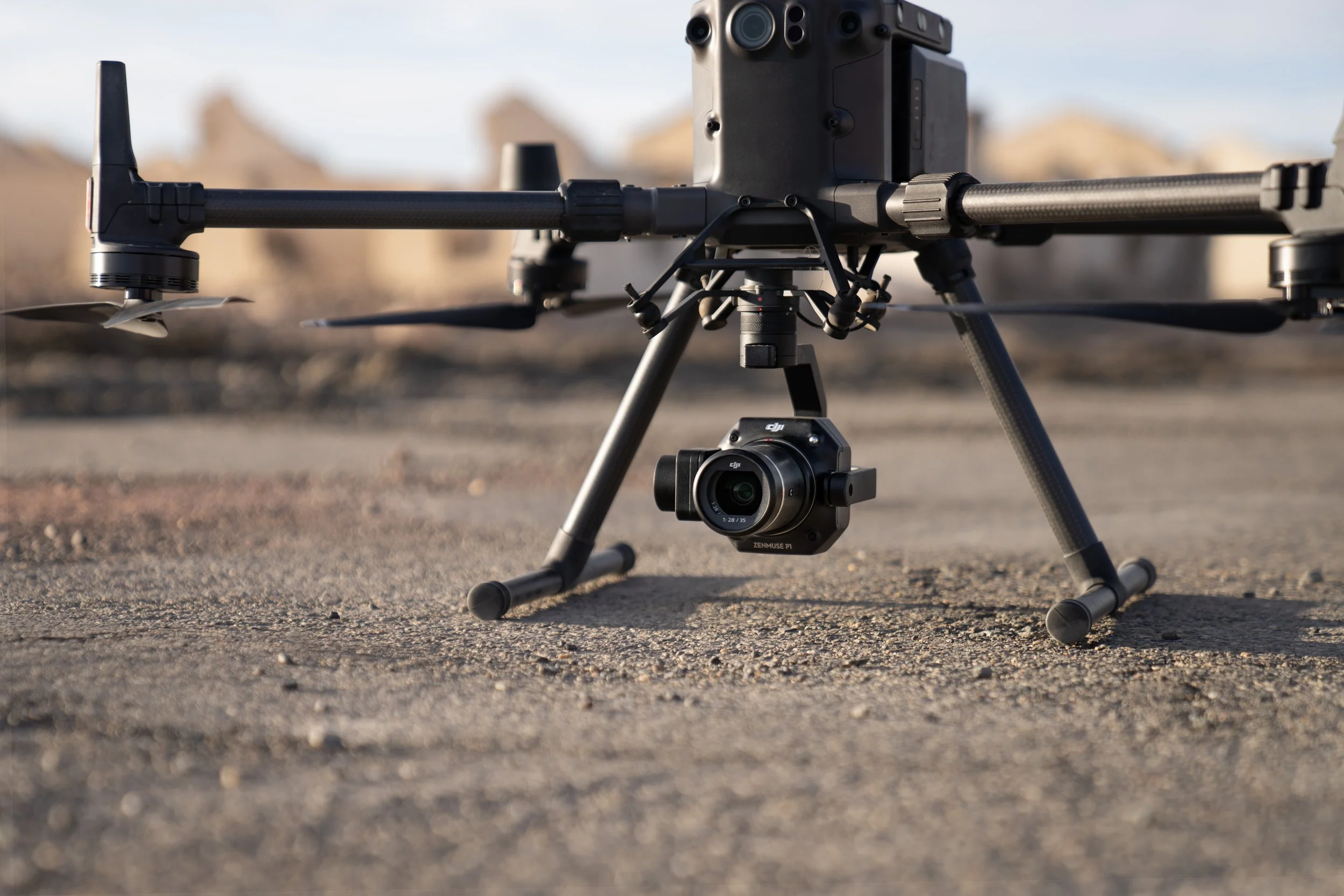
DJI Zenmuse P1
Full-Frame Photogrammetry. Survey-Grade Accuracy.
The DJI Zenmuse P1 sets a new benchmark for aerial photogrammetry. Designed specifically for high-accuracy mapping missions, it combines a 45 MP full-frame sensor with interchangeable fixed-focus lenses to deliver exceptional efficiency and precision.
Engineered for surveying, topographic mapping and 3D reconstruction, the P1 provides the performance, reliability and data integrity required for demanding enterprise geospatial workflows.
Product Overview
The Zenmuse P1 integrates a full-frame 45 MP sensor with a 3-axis stabilised gimbal and global mechanical shutter, purpose-built for professional photogrammetry missions. With Smart Oblique Capture and TimeSync 2.0 microsecond-level synchronisation, it enables accurate, efficient and repeatable aerial data collection.
Explore the core technologies and capabilities below to understand how the P1 enhances mapping accuracy, reduces flight time and streamlines post-processing workflows.
Built for High-Accuracy Mapping
The Zenmuse P1 is designed to capture more detail, cover larger areas and minimise ground control requirements. With the ability to capture images every 0.7 seconds and cover up to 3 km² in a single flight, it significantly improves operational efficiency across large-scale mapping projects.
Equipped with a global mechanical shutter and TimeSync 2.0 system, the P1 delivers centimetre-level accuracy by synchronising camera, flight controller, RTK module and gimbal data at the microsecond level.
From topographic mapping and cadastral surveys to 3D modelling and infrastructure planning, the P1 provides the tools required for modern, high-precision geospatial operations.
Drone Systems
Advanced aerial systems engineered to expand operational capability, accuracy and mission performance.
DJI Matrice 400
The DJI Matrice 400 is an advanced enterprise drone platform engineered for complex industrial operations. With extended endurance, heavy payload capacity and intelligent sensing systems, it supports inspection, infrastructure, utilities and mission-critical deployments at scale.
DJI Dock 3
The DJI Dock 3 is an autonomous drone system designed for continuous remote inspection and public safety operations. Integrating automated deployment with Matrice 4D or 4TD aircraft, it delivers reliable aerial oversight in demanding environments.
DJI Matrice 4E
The DJI Matrice 4E is a compact mapping drone built for high-accuracy surveying and geospatial workflows. Featuring a mechanical shutter wide-angle camera and advanced capture modes, it enables efficient orthophoto and 3D data collection across construction, mining and infrastructure projects.
DJI Matrice 4T
The DJI Matrice 4T is a compact multi-sensor drone designed for inspection, public safety and emergency response operations. Combining high-resolution zoom, thermal imaging and a laser rangefinder, it delivers actionable visual and temperature data for complex missions in challenging environments.
Payloads
Advanced sensor solutions designed to expand capability, accuracy and mission performance.
DJI Zenmuse L3
The Zenmuse L3 is a high precision LiDAR payload designed for detailed 3D mapping and terrain modelling. It captures dense point cloud data with integrated RGB support, making it ideal for surveying, corridor mapping and infrastructure inspection in complex environments.
DJI Zenmuse P1
The Zenmuse P1 is a full frame photogrammetry payload built for efficient large scale mapping. With high resolution imaging and a mechanical shutter, it delivers accurate 2D and 3D data for construction, land surveying and infrastructure projects.
DJI Zenmuse H30T
The Zenmuse H30T combines high resolution zoom optics with thermal imaging for inspection and public safety operations. It enables operators to detect anomalies, monitor assets and gather visual and thermal data from a safe distance.
DJI Zenmuse L2
The Zenmuse L2 integrates LiDAR scanning with an RGB mapping camera to deliver high accuracy terrain capture and asset modelling. It produces reliable point cloud and colourised data for surveying, infrastructure inspection and corridor mapping operations.
Software
Advanced software platforms designed to transform drone data into accurate insight and operational intelligence.
DJI Terra
DJI Terra is a professional drone mapping platform designed for processing aerial imagery and LiDAR datasets. Supporting photogrammetry reconstruction and terrain modelling, it converts captured drone data into accurate maps, 3D models and measurable outputs for surveying, construction and infrastructure analysis.
DJI FlightHub 2
DJI FlightHub 2 is a cloud based drone operations platform designed for remote fleet management and mission coordination. Integrating real time data streaming, flight planning and team collaboration, it provides centralised control and operational visibility for enterprise drone deployments.
FAQs
-
The Zenmuse P1 is compatible with the DJI Matrice 300 RTK and Matrice 350 RTK platforms.
-
When used with RTK positioning and appropriate overlap settings, the P1 can achieve approximately 3 cm horizontal and 5 cm vertical accuracy without ground control points under standard conditions.
-
The P1 features a 45 MP full-frame CMOS sensor designed specifically for high-precision aerial photogrammetry missions.
-
Yes. The Zenmuse P1 uses a global mechanical shutter with speeds up to 1/2000 seconds, reducing motion blur and improving mapping accuracy.
-
The P1 can capture an image every 0.7 seconds and cover up to approximately 3 km² in a single flight, depending on flight parameters and overlap settings.
-
The P1 supports interchangeable fixed-focus 24 mm, 35 mm and 50 mm DJI DL lenses to suit different mapping and modelling requirements.
-
Zenmuse P1 data is processed using DJI Terra for orthomosaics, 3D modelling and reconstruction workflows.
-
Yes. Smart Oblique Capture allows the gimbal to automatically rotate and capture the necessary angles for 3D reconstruction, improving efficiency and reducing post-processing workload.
Ready to Upgrade Your Capability?
Speak to our team to discuss pricing, availability and the most suitable configuration for your operational requirements. We can advise on payload selection, regulatory considerations, training and ongoing support to ensure you deploy with confidence.