

Explore our range of payloads designed to help you move forward with confidence, wherever you're headed next.
Explore The Zenmuse L3
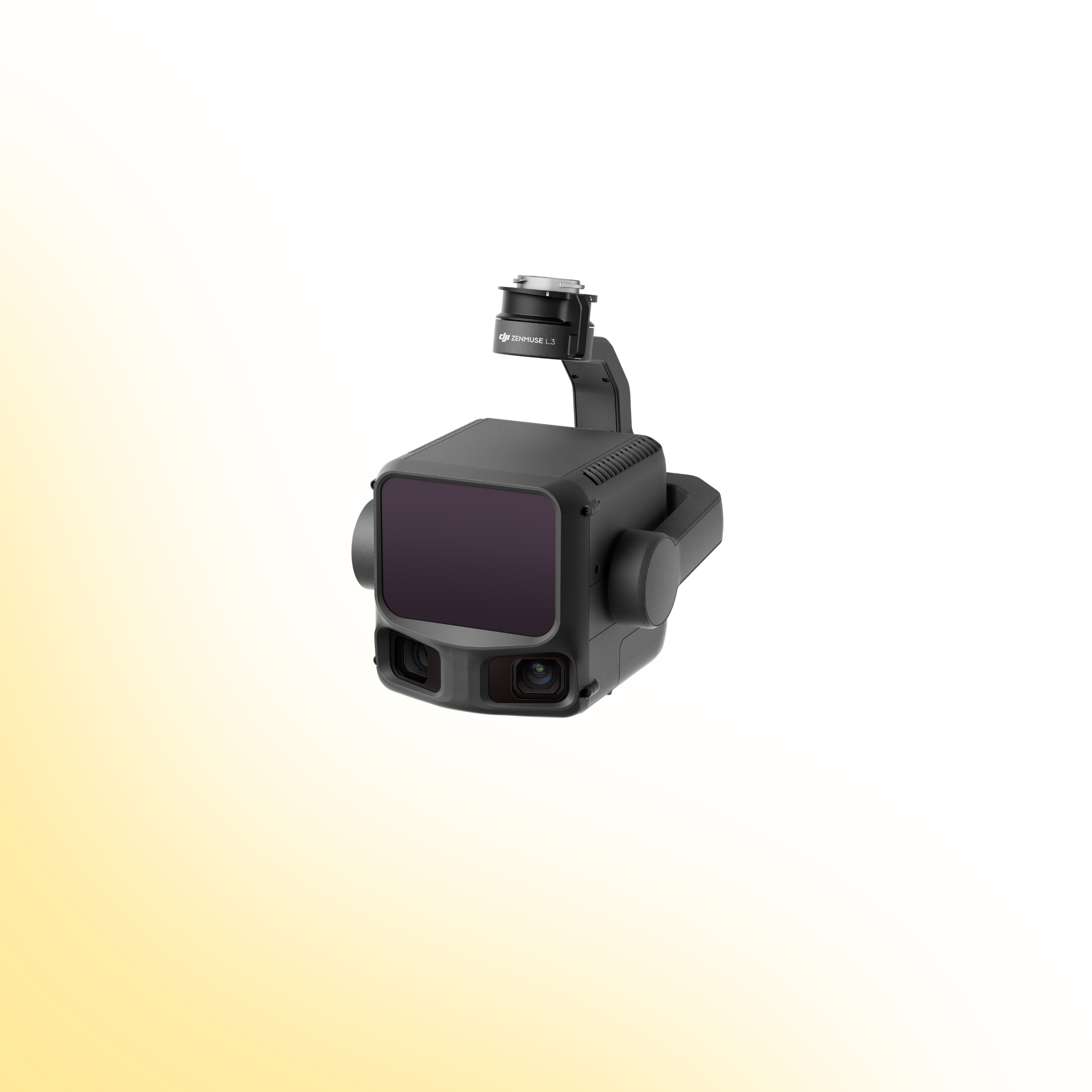
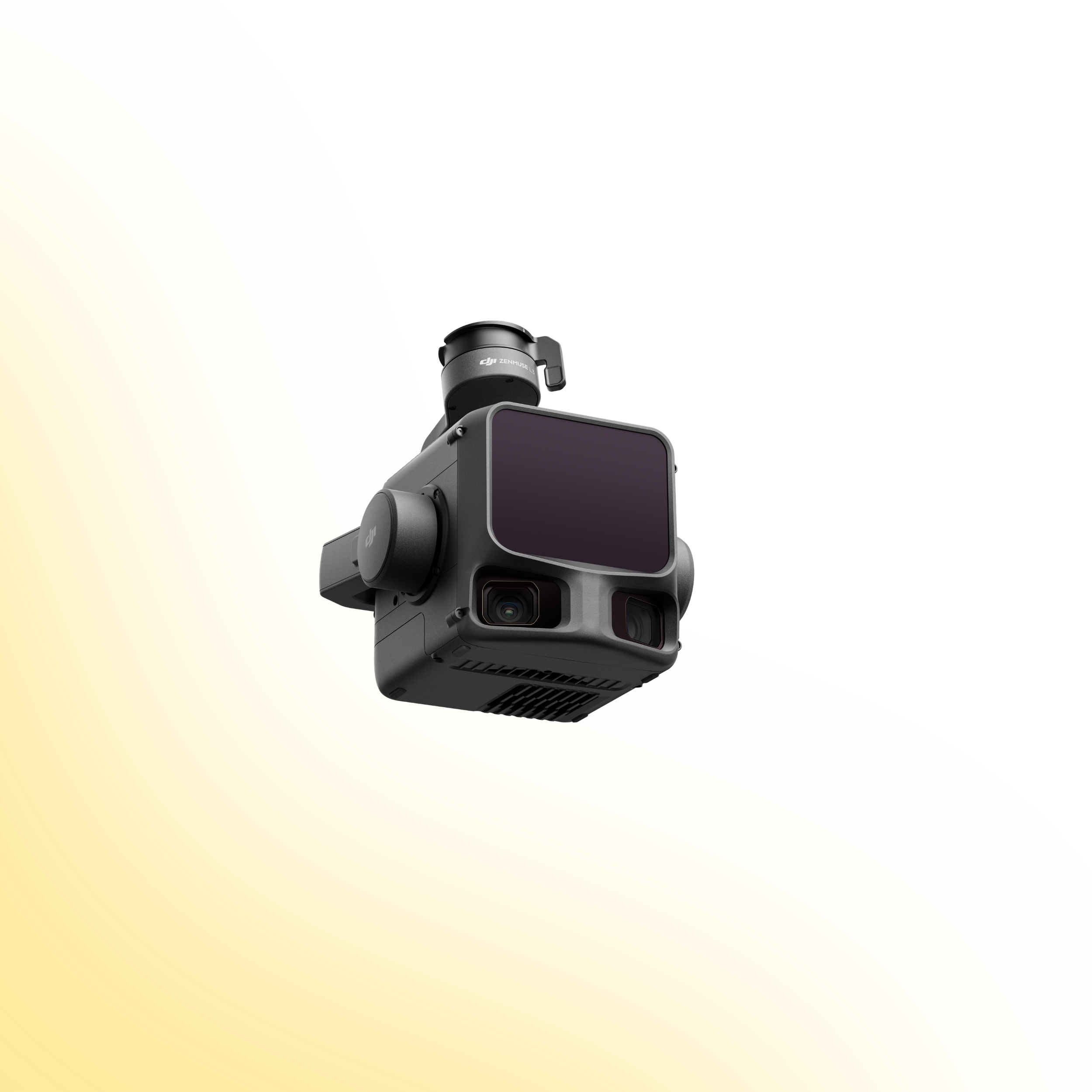
DJI Zenmuse L3
Integrated LiDAR and Imaging Performance
The DJI Zenmuse L3 sets a new benchmark for aerial LiDAR operations. Designed for high-precision 3D data capture, it integrates advanced LiDAR scanning with an RGB imaging system to deliver accurate, high-density point clouds in a single workflow.
Engineered for surveying, infrastructure inspection, utilities and terrain modelling, the L3 provides the performance, reliability and efficiency required for demanding enterprise mapping missions.
Product Overview
The Zenmuse L3 combines high-accuracy LiDAR sensing with integrated visual data capture to streamline complex surveying operations. With long-range detection, dense point cloud generation and precise IMU integration, it enables efficient 3D modelling across varied environments.
Explore the core capabilities below to understand how the L3 enhances data accuracy, operational efficiency and end-to-end mapping performance.

A new industry standard for enterprise operations
The Zenmuse L3 is built to capture more detail, cover greater distances and simplify post-processing workflows. By combining advanced LiDAR scanning with an integrated RGB camera and high-precision inertial measurement system, it delivers consistent, survey-grade results across complex terrain.
From topographic mapping and corridor surveys to infrastructure inspection and forestry analysis, the L3 provides the tools required for modern, high-accuracy 3D data collection.
Drone Systems
Advanced aerial systems engineered to expand operational capability, accuracy and mission performance.
DJI Matrice 400
The DJI Matrice 400 is an advanced enterprise drone platform engineered for complex industrial operations. With extended endurance, heavy payload capacity and intelligent sensing systems, it supports inspection, infrastructure, utilities and mission-critical deployments at scale.
DJI Dock 3
The DJI Dock 3 is an autonomous drone system designed for continuous remote inspection and public safety operations. Integrating automated deployment with Matrice 4D or 4TD aircraft, it delivers reliable aerial oversight in demanding environments.
DJI Matrice 4E
The DJI Matrice 4E is a compact mapping drone built for high-accuracy surveying and geospatial workflows. Featuring a mechanical shutter wide-angle camera and advanced capture modes, it enables efficient orthophoto and 3D data collection across construction, mining and infrastructure projects.
DJI Matrice 4T
The DJI Matrice 4T is a compact multi-sensor drone designed for inspection, public safety and emergency response operations. Combining high-resolution zoom, thermal imaging and a laser rangefinder, it delivers actionable visual and temperature data for complex missions in challenging environments.
Payloads
Advanced sensor solutions designed to expand capability, accuracy and mission performance.
DJI Zenmuse L3
The Zenmuse L3 is a high precision LiDAR payload designed for detailed 3D mapping and terrain modelling. It captures dense point cloud data with integrated RGB support, making it ideal for surveying, corridor mapping and infrastructure inspection in complex environments.
DJI Zenmuse P1
The Zenmuse P1 is a full frame photogrammetry payload built for efficient large scale mapping. With high resolution imaging and a mechanical shutter, it delivers accurate 2D and 3D data for construction, land surveying and infrastructure projects.
DJI Zenmuse H30T
The Zenmuse H30T combines high resolution zoom optics with thermal imaging for inspection and public safety operations. It enables operators to detect anomalies, monitor assets and gather visual and thermal data from a safe distance.
DJI Zenmuse L2
The Zenmuse L2 integrates LiDAR scanning with an RGB mapping camera to deliver high accuracy terrain capture and asset modelling. It produces reliable point cloud and colourised data for surveying, infrastructure inspection and corridor mapping operations.
Software
Advanced software platforms designed to transform drone data into accurate insight and operational intelligence.
DJI Terra
DJI Terra is a professional drone mapping platform designed for processing aerial imagery and LiDAR datasets. Supporting photogrammetry reconstruction and terrain modelling, it converts captured drone data into accurate maps, 3D models and measurable outputs for surveying, construction and infrastructure analysis.
DJI FlightHub 2
DJI FlightHub 2 is a cloud based drone operations platform designed for remote fleet management and mission coordination. Integrating real time data streaming, flight planning and team collaboration, it provides centralised control and operational visibility for enterprise drone deployments.
FAQs
-
The Zenmuse L3 is designed for use with the DJI Matrice 400 and connects via the dedicated single gimbal interface for optimal performance.
-
At typical mapping altitudes, the L3 delivers survey-grade accuracy, achieving approximately 3 cm vertical and 4 cm horizontal accuracy under standard operating conditions.
-
Depending on pulse repetition frequency and environmental conditions, the L3 can detect targets at distances approaching 900–950 metres.
-
The Zenmuse L3 supports up to 16 returns, enabling improved vegetation penetration and more detailed terrain modelling in complex environments.
-
The L3 supports multiple scan modes, including Linear, Star and Non-Repetitive scanning, allowing optimisation for terrain mapping, forestry and structural surveys.
-
When mounted on a Matrice 400, the L3 can cover large areas efficiently, with typical missions capturing several square kilometres per flight depending on altitude and overlap settings.
-
Yes. The L3 integrates high-resolution RGB imaging alongside LiDAR data, enabling colourised point clouds and improved visual context for post-processing.
-
The Zenmuse L3 integrates with DJI Terra for LiDAR data processing, point cloud generation and 3D modelling workflows.
Ready to Upgrade Your Capability?
Speak to our team to discuss pricing, availability and the most suitable configuration for your operational requirements. We can advise on payload selection, regulatory considerations, training and ongoing support to ensure you deploy with confidence.