

Explore our range of payloads designed to help you move forward with confidence, wherever you're headed next.
Explore The DJI FlyCart 100
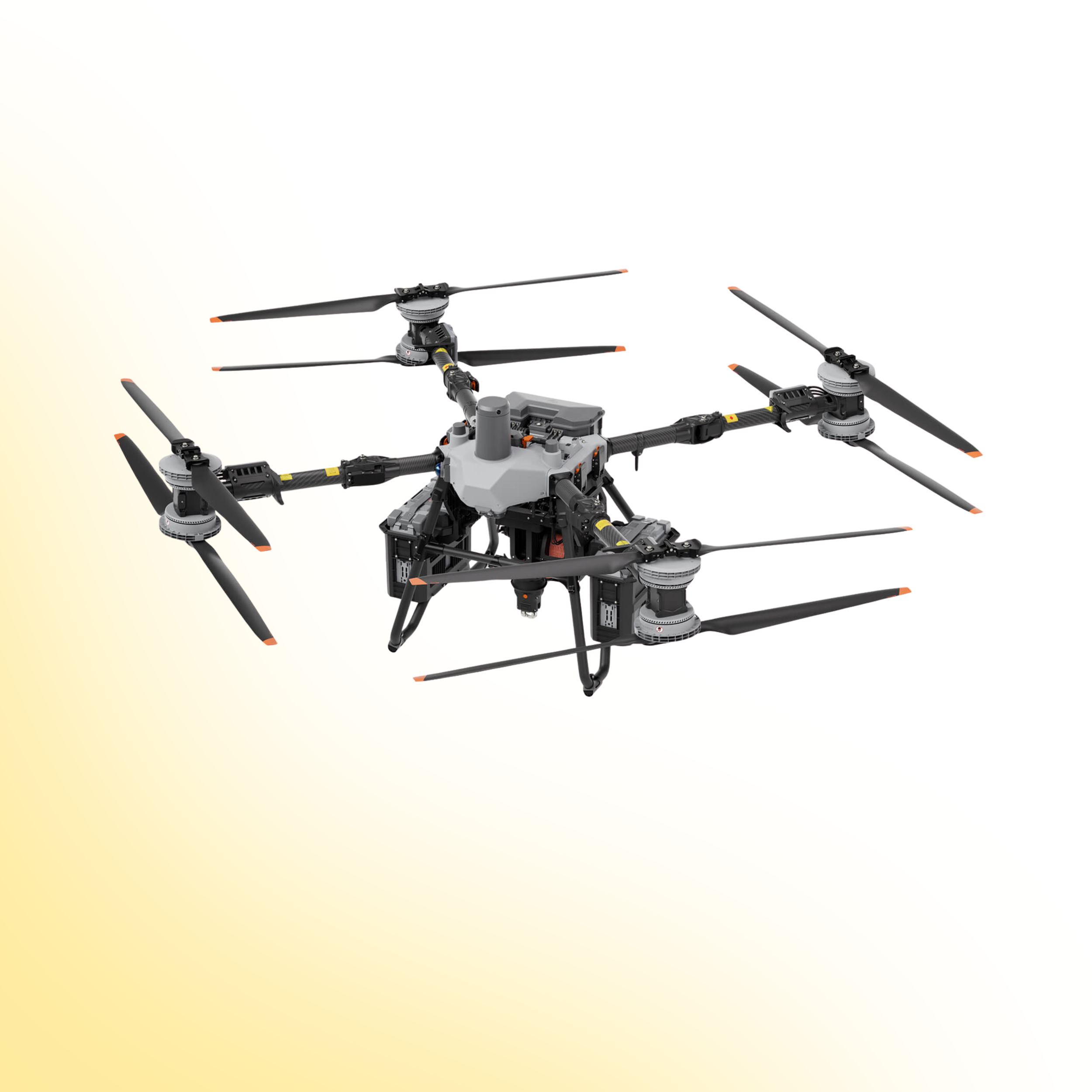
DJI FlyCart 100
Heavy Lift Drone Delivery for Critical Logistics
The DJI FlyCart 100 is a heavy lift delivery drone designed to transport equipment, materials and critical supplies across challenging environments. Combining exceptional payload capacity with intelligent flight systems, it enables organisations to move essential cargo safely, efficiently and without relying on traditional ground access.
Engineered for surveying, infrastructure inspection, utilities and terrain modelling, the L3 provides the performance, reliability and efficiency required for demanding enterprise mapping missions.
Product Overview
DJI FlyCart 100 has been developed for organisations that need to transport equipment into locations where traditional access is slow, difficult or unsafe. Designed around intelligent cargo delivery, it combines high payload capability, advanced obstacle sensing and automated delivery workflows to improve efficiency while reducing operational risk.
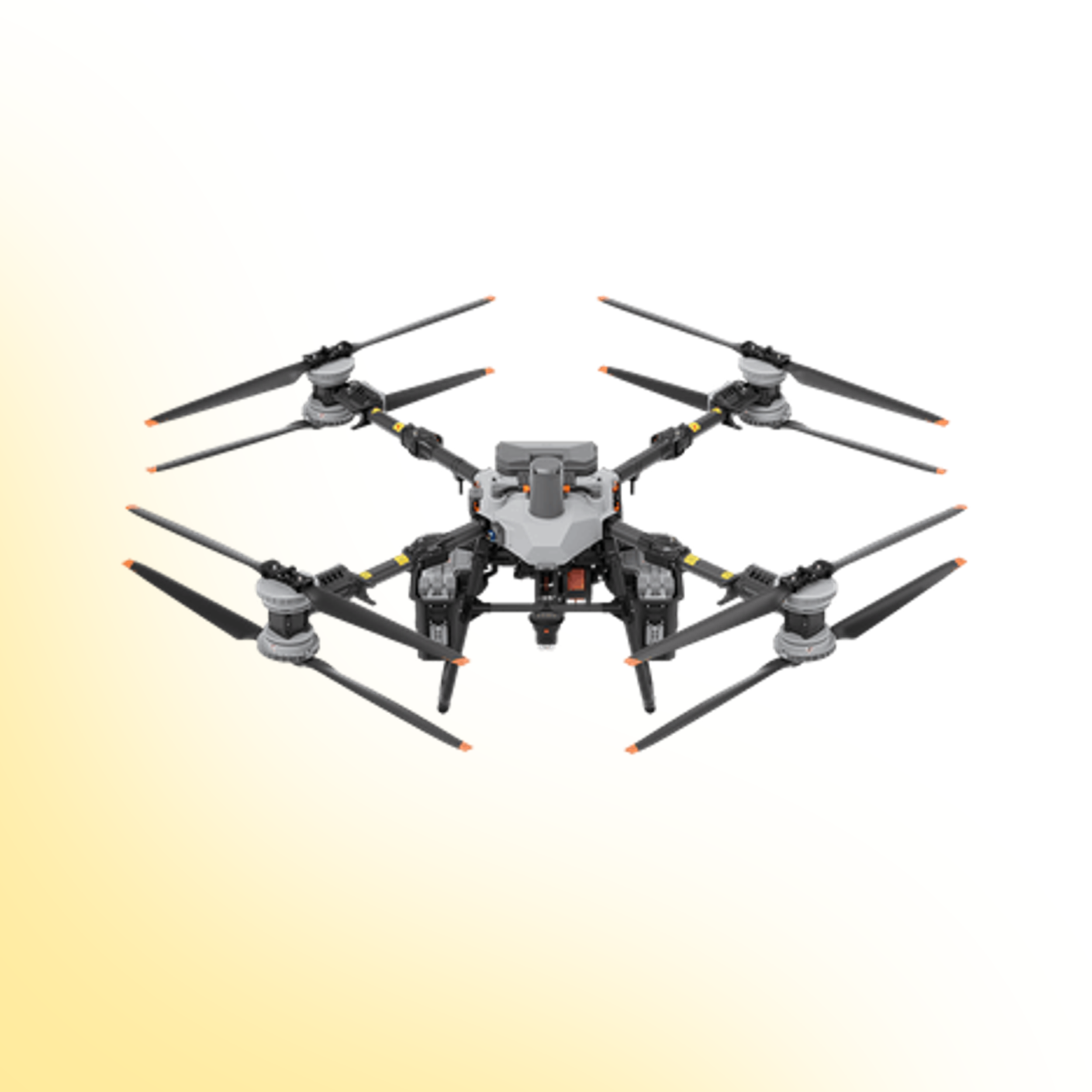
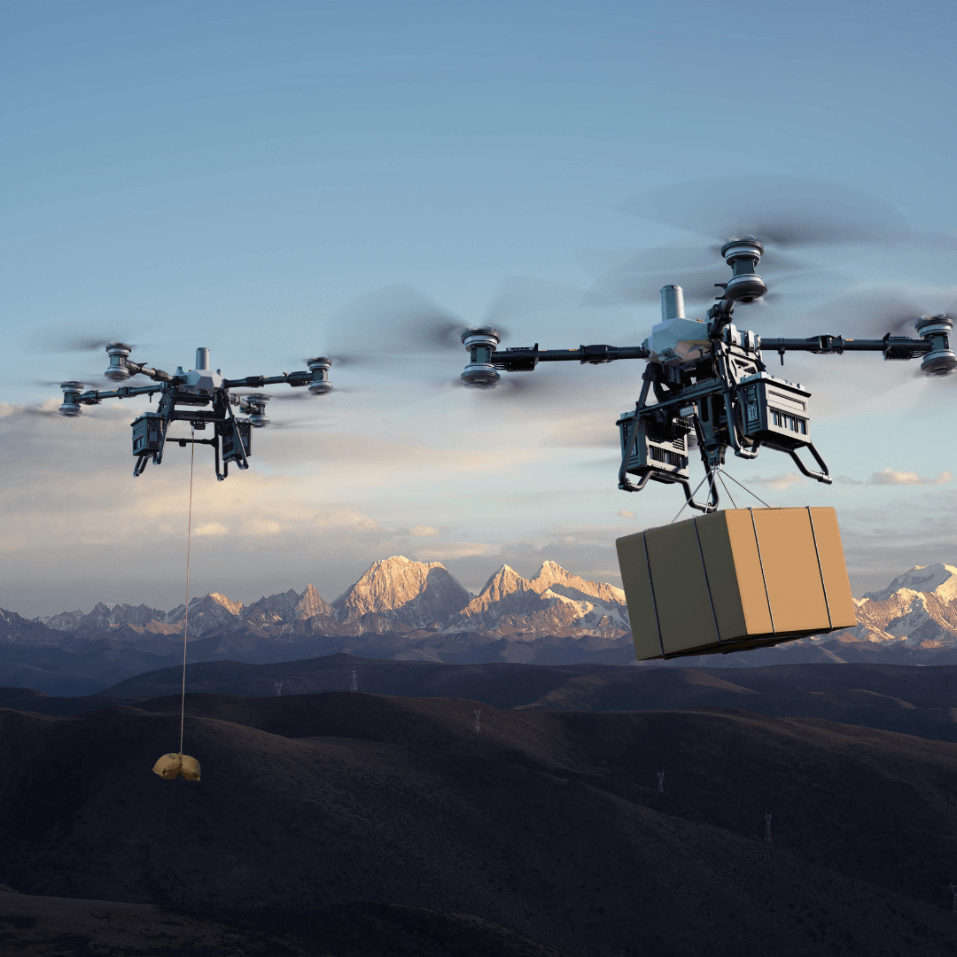
Supporting both cargo box and winch delivery methods, FlyCart 100 offers the flexibility required for complex industrial environments where precision and reliability are critical.
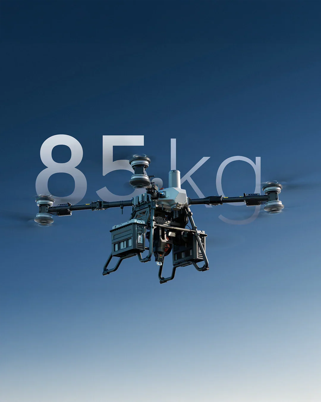
Up to 85 kg Payload Capacity
The DJI FlyCart 100 is built for heavy lift aerial delivery, carrying up to 80 kg in single battery mode or up to 85 kg in dual battery mode. With a maximum takeoff weight of 170 kg, it is designed to move equipment, tools and essential supplies where ground access is slow, unsafe or restricted.
From utility maintenance and construction logistics to emergency response and remote infrastructure, FlyCart 100 provides a practical aerial transport solution for demanding operational environments.

Designed for Controlled Cargo Operations
FlyCart 100 supports delivery over distances up to 12 km in dual battery mode or 6 km in single battery mode at under 149.9 kg takeoff weight. It also includes a 0 to 30 metre winch system, IP55 protection, 12 m/s wind resistance and DJI O4 video transmission up to 10 km under CE conditions.
With LiDAR, radar, quad vision sensing and an integrated parachute system, FlyCart 100 is designed to support safer cargo delivery across complex industrial, infrastructure and remote site operations.
Built for Demanding Logistics Operations
The DJI FlyCart 100 is designed to transport equipment, materials and essential supplies where traditional ground access is difficult, slow or impractical. Combining high payload capacity with intelligent delivery methods, it enables organisations to move critical cargo safely and efficiently across demanding operational environments.
From utility maintenance and construction projects to emergency response and remote infrastructure, FlyCart 100 provides a dependable aerial logistics solution that reduces mobilisation time and improves operational flexibility.
Drone Systems
Advanced aerial systems engineered to expand operational capability, accuracy and mission performance.
DJI Matrice 400
The DJI Matrice 400 is an advanced enterprise drone platform engineered for complex industrial operations. With extended endurance, heavy payload capacity and intelligent sensing systems, it supports inspection, infrastructure, utilities and mission-critical deployments at scale.
DJI Dock 3
The DJI Dock 3 is an autonomous drone system designed for continuous remote inspection and public safety operations. Integrating automated deployment with Matrice 4D or 4TD aircraft, it delivers reliable aerial oversight in demanding environments.
DJI Matrice 4E
The DJI Matrice 4E is a compact mapping drone built for high-accuracy surveying and geospatial workflows. Featuring a mechanical shutter wide-angle camera and advanced capture modes, it enables efficient orthophoto and 3D data collection across construction, mining and infrastructure projects.
DJI Matrice 4T
The DJI Matrice 4T is a compact multi-sensor drone designed for inspection, public safety and emergency response operations. Combining high-resolution zoom, thermal imaging and a laser rangefinder, it delivers actionable visual and temperature data for complex missions in challenging environments.
Payloads
Advanced sensor solutions designed to expand capability, accuracy and mission performance.
DJI Zenmuse L3
The Zenmuse L3 is a high precision LiDAR payload designed for detailed 3D mapping and terrain modelling. It captures dense point cloud data with integrated RGB support, making it ideal for surveying, corridor mapping and infrastructure inspection in complex environments.
DJI Zenmuse P1
The Zenmuse P1 is a full frame photogrammetry payload built for efficient large scale mapping. With high resolution imaging and a mechanical shutter, it delivers accurate 2D and 3D data for construction, land surveying and infrastructure projects.
DJI Zenmuse H30T
The Zenmuse H30T combines high resolution zoom optics with thermal imaging for inspection and public safety operations. It enables operators to detect anomalies, monitor assets and gather visual and thermal data from a safe distance.
DJI Zenmuse L2
The Zenmuse L2 integrates LiDAR scanning with an RGB mapping camera to deliver high accuracy terrain capture and asset modelling. It produces reliable point cloud and colourised data for surveying, infrastructure inspection and corridor mapping operations.
FAQs
-
The DJI FlyCart 100 is a heavy lift delivery drone designed to transport equipment, materials and essential supplies across challenging or inaccessible environments. It is built for logistics operations in sectors including utilities, construction, infrastructure and emergency response.
-
The FlyCart 100 can carry up to 80 kg using a single battery configuration or up to 65 kg when operating with dual batteries. Payload capacity varies depending on the battery configuration and mission profile.
-
The FlyCart 100 supports two delivery methods: a cargo box for transporting materials and an intelligent winch system for lowering payloads into locations where landing is not possible.
-
The DJI FlyCart 100 has a maximum take-off weight of 170 kg, enabling it to transport heavy payloads while maintaining stable flight performance.
-
The aircraft incorporates LiDAR, radar, fisheye vision sensors, intelligent obstacle sensing and an integrated emergency parachute system to support safe cargo operations.
-
Yes. The FlyCart 100 features an IP55 rating for dust and water resistance, making it suitable for demanding outdoor and industrial environments.
-
The FlyCart 100 uses DJI's O4 Enterprise transmission system, providing stable long-range communication and reliable control during cargo missions.
-
The FlyCart 100 is well suited to utilities, construction, mining, renewable energy, infrastructure maintenance, public safety and emergency response, where transporting equipment quickly and safely is critical.
-
Yes. The intelligent winch system allows cargo to be lowered accurately into confined or hazardous locations, removing the need for the aircraft to land.
-
Yes. The FlyCart 100 is designed for professional logistics workflows and can be deployed as part of wider enterprise drone operations to improve efficiency, reduce manual handling and increase access to remote locations.
Ready to Upgrade Your Capability?
Speak to our team to discuss pricing, availability and the most suitable configuration for your operational requirements. We can advise on payload selection, regulatory considerations, training and ongoing support to ensure you deploy with confidence.