What is an orthomosaic drone survey?
An orthomosaic drone survey uses aerial images captured by a drone to create a detailed, map-style image of a site. Unlike a standard photograph, an orthomosaic is processed so it can provide a more accurate top-down view that helps clients understand site layout, progress, condition and change over time.
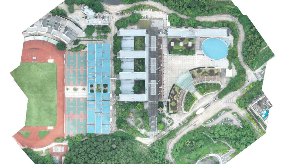
Orthomosaics are commonly used across construction, infrastructure, utilities, land management, industrial sites and asset monitoring.
An orthomosaic is a detailed top-down map created from drone images.
It is different from a single aerial photo because multiple images are processed together.
Orthomosaics can support site records, progress tracking and asset management.
They can help teams view large sites clearly from above.
The usefulness of the output depends on how the survey is planned, captured and processed.
What does this mean?
During an orthomosaic drone survey, a drone captures a series of overlapping images across a site.
Those images are then processed together to create one larger, top-down image. The result can look like a detailed aerial map, giving clients a clear view of the site as a whole.
This can be useful for construction sites, utility assets, industrial facilities, land areas, roof spaces, access routes, stockpiles and infrastructure environments.
An orthomosaic can help teams see the bigger picture, rather than relying on separate images or ground-level views.
Why does it matter?
Orthomosaics are useful because they provide a clear visual record of a site at a specific point in time.
That can help clients review progress, compare changes, support planning, brief teams, record site condition and communicate information to stakeholders.
For projects that require repeat monitoring, orthomosaics can also be captured over time to show how a site is changing.
They are not always the only deliverable needed, but they can form an important part of a wider drone survey workflow alongside point clouds, 3D models, terrain data, inspection imagery or reports.
Team UAV Insight
At Team UAV, orthomosaic outputs are planned around how the client needs to use the data.
For some projects, an orthomosaic may be used as a clear visual site record. For others, it may support progress tracking, asset management, inspection planning or wider survey deliverables.
The important point is that the output needs to be useful. That means understanding the site, the level of detail required and whether the orthomosaic needs to sit alongside other outputs such as point clouds, LiDAR data, 3D models or inspection reports.
Our focus is on delivering drone survey data that supports real project decisions, not just producing an image from above.
Speak to Team UAV
At Team UAV, orthomosaic outputs are planned around how the client needs to use the data.
For some projects, an orthomosaic may be used as a clear visual site record. For others, it may support progress tracking, asset management, inspection planning or wider survey deliverables.
The important point is that the output needs to be useful. That means understanding the site, the level of detail required and whether the orthomosaic needs to sit alongside other outputs such as point clouds, LiDAR data, 3D models or inspection reports.
Our focus is on delivering drone survey data that supports real project decisions, not just producing an image from above.
FAQS
-
No. A drone photo is a single image. An orthomosaic is created by processing multiple overlapping drone images into one detailed top-down site view.
-
Orthomosaics are used for site records, mapping, progress tracking, asset management, inspection planning, land monitoring and stakeholder communication.
-
An orthomosaic can support measurement when it has been captured and processed correctly for that purpose. The required accuracy should be agreed before the survey begins.