What is a point cloud survey?
A point cloud survey creates a 3D digital representation of a site, structure or asset using millions of measured points. These points show the shape, position and detail of the surveyed area, helping teams measure, inspect, model and understand the environment in three dimensions.
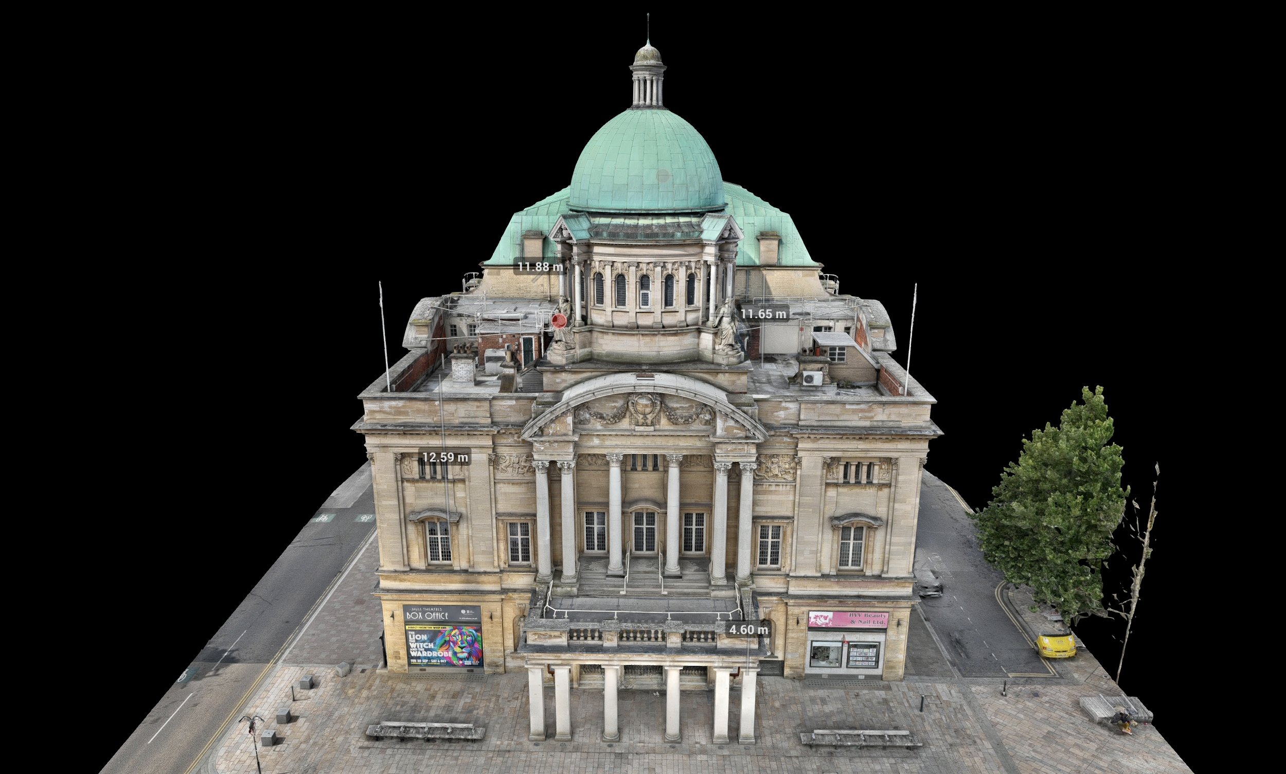
Point clouds can be created from drone LiDAR, photogrammetry or ground-based scanning.
A point cloud is a 3D dataset made from millions of points.
Each point represents a measured position in space.
Point clouds can show terrain, buildings, structures, assets and confined spaces.
They are useful for measurement, modelling, inspection and asset records.
The right capture method depends on the site and required output.
What does this mean?
A point cloud is not a normal photograph. It is a measurable 3D dataset.
Each point has a position, and together those points form a digital version of the surveyed area. This can be viewed, measured and used by surveyors, engineers, designers, asset managers and project teams.
Point clouds are commonly used for topographic surveys, stockpile measurement, infrastructure inspection, digital twins, construction records, confined space surveys and complex asset mapping.
Why does it matter?
Point clouds help clients move from simple visual records to measurable data.
Instead of only seeing what a site looks like, teams can understand shape, distance, height, volume and position. This can support design, maintenance, planning, condition assessment and long-term asset management.
For complex sites, a point cloud can also reduce the need for repeated manual measurement and provide a clear record that can be revisited later.
Team UAV Insight
At Team UAV, point cloud surveys are often part of wider drone survey and inspection workflows.
Depending on the project, we may capture point cloud data using drone LiDAR, photogrammetry, confined space drones or ground-based scanning. The right method depends on the environment, accuracy requirements, access constraints and final deliverables.
For clients, the important part is not just receiving a point cloud. It is receiving data that can actually be opened, understood and used by the right teams.
Speak to Team UAV
Team UAV provides point cloud surveys for infrastructure, utilities, construction, confined spaces, industrial sites and asset management.
Get in touch with our team to discuss your survey requirements.
FAQS
-
No. A point cloud is made of individual measured points. A 3D model or mesh may be created from that data, depending on the project.
-
Yes. Point clouds can be used to measure distance, height, volume, position and asset condition, depending on how the survey was captured and processed.
-
Yes. Drones can create point clouds using LiDAR or photogrammetry, depending on the site and required output.