How much does a LiDAR drone survey cost?
A LiDAR drone survey usually costs more than a standard imagery-based survey because it uses specialist equipment, technical capture methods and detailed processing. The final cost depends on the site, required accuracy, terrain, deliverables and how the LiDAR data will be used.
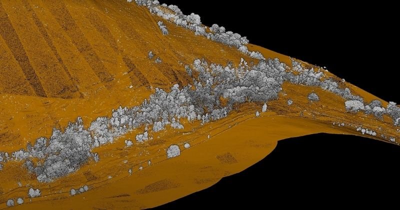
LiDAR is often chosen when clients need reliable spatial data, terrain information or point cloud outputs, especially where standard photogrammetry may not be the best method.
LiDAR drone survey cost depends on site size, terrain and required outputs.
LiDAR usually costs more than standard photogrammetry.
Processing, classification and point cloud delivery affect the final price.
LiDAR can be useful for vegetation, terrain, infrastructure and complex environments.
The value depends on whether LiDAR is the right tool for the project.
What does this mean?
A LiDAR drone survey uses laser scanning to capture spatial data from the air. This can produce dense point cloud outputs that help clients understand terrain, structures, vegetation and asset environments.
Compared with standard imagery-based mapping, LiDAR often requires more specialist payloads, careful flight planning, calibration, data processing and quality checks.
The cost is not just for the flight. It includes the technical workflow needed to turn raw LiDAR data into usable deliverables.
Why does it matter?
LiDAR can be extremely useful, but it is not needed for every project.
For some sites, photogrammetry may provide the required output. For others, LiDAR may be the better choice, especially where vegetation, elevation, terrain modelling, corridor mapping or complex asset environments are involved.
Choosing the wrong method can either increase cost unnecessarily or result in data that does not meet the project requirement.
Team UAV Insight
At Team UAV, we help clients decide whether LiDAR is actually needed.
We use drone LiDAR where it adds value to the project, not simply because it is the most advanced option. That means looking at the site conditions, accuracy requirement, deliverables and how the final data will be used by the client.
Where LiDAR is the right approach, we can support capture, processing and delivery of point cloud and survey outputs for infrastructure, utilities, construction, environmental and industrial projects.
Speak to Team UAV
Team UAV provides drone LiDAR survey services for infrastructure, utilities, construction, environmental and industrial projects.
Get in touch with our team to discuss whether LiDAR is the right method for your site.
FAQS
-
LiDAR often requires specialist payloads, technical flight planning, processing, classification and data handling. That usually makes it more expensive than standard imagery-based mapping.
-
LiDAR can be useful for terrain modelling, vegetation, corridor mapping, infrastructure, complex environments and projects requiring detailed point cloud outputs.
-
Common deliverables include point clouds, terrain data, surface models, classified data, contours, cross-sections and other project-specific survey outputs.