How can drones support heritage building inspections?
Drones can support heritage building inspections by capturing detailed visual data of roofs, facades, towers, stonework, chimneys, gutters and other difficult access areas. They give conservation teams, building owners, surveyors and contractors a safer way to understand visible condition before arranging more intrusive access.
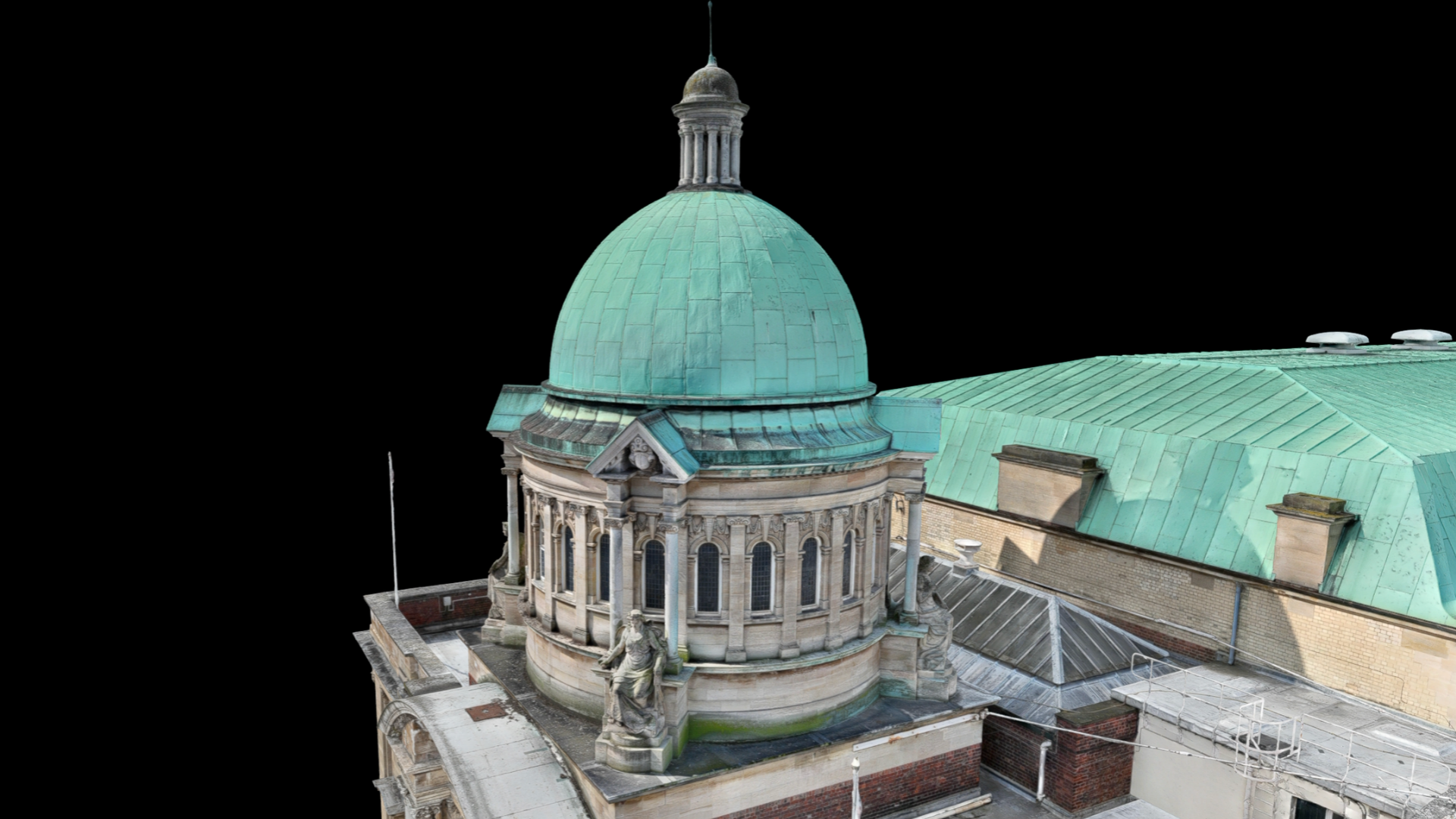
For heritage buildings, the value is not just aerial imagery. It is having a clear visual record that supports maintenance planning, conservation work, repair decisions and long-term asset management.
Drones can inspect difficult access areas on heritage buildings.
They can capture high-resolution imagery, video and visual condition records.
Drone inspections can reduce the need for early scaffolding or rope access.
They can support conservation, maintenance, repair planning and documentation.
Some findings may still need physical inspection by a qualified specialist.
What does this mean?
Heritage buildings often include complex structures and difficult access areas.
This may include roof coverings, towers, spires, chimneys, parapets, gutters, stonework, brickwork, windows, facades and decorative features. These areas can be difficult to inspect safely from the ground and may require costly access methods if a full physical inspection is arranged immediately.
Drones can help by capturing detailed imagery and video from different angles, allowing teams to review visible condition before deciding what further access or specialist assessment is needed.
The final outputs can support condition records, maintenance planning, conservation reports, repair scopes and stakeholder communication.
Why does it matter?
Heritage buildings need careful inspection because repairs, access and conservation decisions often require good evidence.
A drone inspection can help teams understand visible issues such as damaged roof coverings, blocked gutters, vegetation growth, cracking, staining, loose materials, weather damage or areas of deterioration.
This can help building owners and project teams prioritise works, reduce unnecessary access and plan further investigation more effectively.
For heritage sites, drone data can also provide a useful visual record over time, helping teams compare condition and monitor change without repeatedly arranging intrusive access methods.
Team UAV Insight
At Team UAV, heritage building inspections are planned around the sensitivity of the asset and the information the client needs.
We understand that heritage sites often involve access constraints, public safety considerations, conservation requirements and the need for clear documentation. The data needs to support building owners, conservation teams, surveyors, engineers, contractors and stakeholders.
For some heritage projects, this may involve roof or facade imagery. For others, it may involve detailed visual records, repeat monitoring, 3D modelling, LiDAR capture or inspection data to help plan further access.
Our focus is on delivering clear, useful data that supports safer inspection, better planning and more informed conservation decisions.
Speak to Team UAV
Team UAV provides drone inspection and survey services for heritage buildings, difficult access structures, infrastructure and complex environments.
Get in touch with our team to discuss how drone data could support your heritage building inspection or conservation project.
FAQS
-
Drones can support inspection of roofs, facades, towers, spires, chimneys, parapets, gutters, windows, stonework, brickwork and other difficult access areas.
-
Not always. Drones can provide valuable visual data and help target further work, but some defects may still need physical inspection or repair access.
-
Drones can help reduce unnecessary access, provide detailed visual records and support better planning for maintenance, conservation and repair work.