
Case Study:
Digley Reservoir Survey
Overview
The aim of the Digley Reservoir project was to produce a complete visual and measurable understanding of the site’s layout and key assets, enabling accurate structural assessment and long-term maintenance planning.
To achieve this, Team UAV was tasked with:
Conducting a full LiDAR survey of the reservoir and dam, both upstream and downstream.
Achieving 0.2 cm resolution in the inspection of the upstream dam wall face.
Capturing and assessing overflow structures, bell tower, service shaft, and other confined spaces.
Integrating all captured datasets into a single, high-resolution 3D model for analysis, future monitoring, site induction, standard operating procedures, and emergency response.
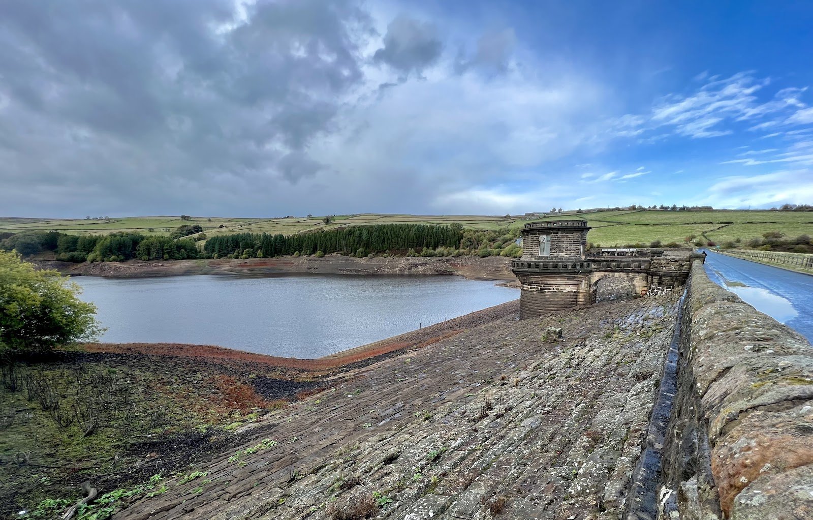
Team UAV recently completed a detailed survey of Digley Reservoir for our long standing client Yorkshire Water. We combined aerial, ground, and confined space inspections to deliver a complete, high-accuracy dataset. The work included assessing overflow structures, service shafts, and the reservoir dam wall to build a complete, high-accuracy dataset that supports safe and informed asset management. By combining photogrammetry and LiDAR datasets, we achieved exceptional precision across the entire site.
Project Objectives.
Approach.
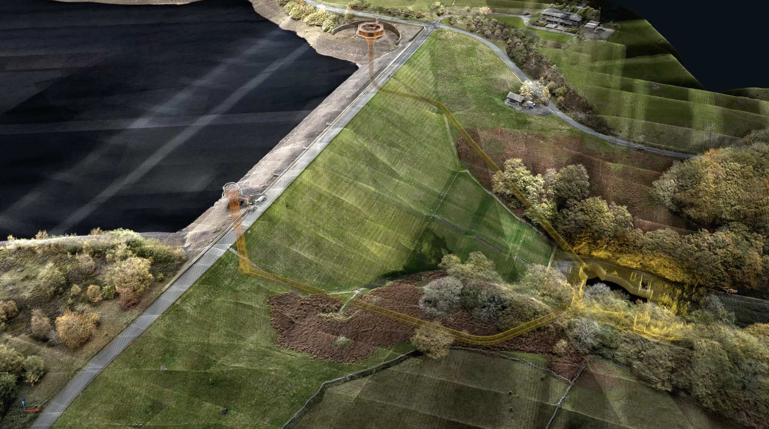
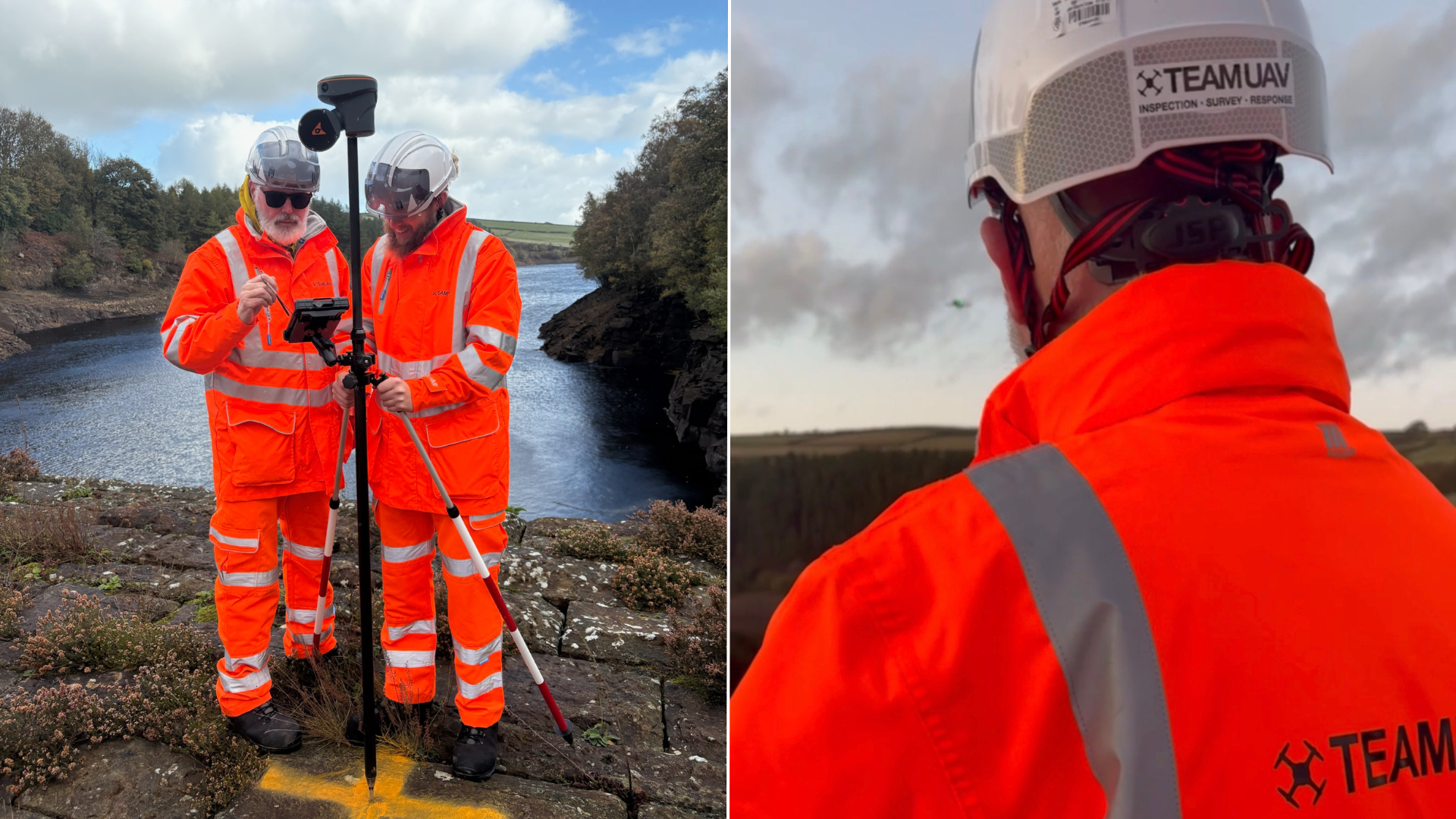
The survey combined multiple capture techniques to ensure a complete and accurate representation of the site. Aerial and ground-based data were collected to map the reservoir and dam surfaces in high detail, while a specialised confined space drone was deployed to inspect internal areas of the bell tower and outflow structures.

Access was achieved from both the top and bottom of the outflow system, allowing both flights to be joined seamlessly and creating a continuous point cloud model of the internal structure. This approach eliminated the need for manual entry into hazardous areas while providing an unprecedented level of visual and spatial detail.
The combination of LiDAR and photogrammetry data allowed the team to produce a fully integrated 3D model of the entire reservoir, dam, and internal systems with unmatched clarity.
Data, Processing and Technical Detail.
The capture includes multiple LiDAR slam and photogrammetric surveys which all require to be added to the same coordinate system. As well as utilising RTK GNSS on devices, ground control is acquired across the dam to ensure that all models align to OSGB36(OSTN15).
In a GPS Denied environment, i.e. a confined space, a survey grade payload was used to increase accuracy, whilst also ensuring that adequate overlap with the exterior was captured to enable registration from local to Georeferenced Coordinate System.
The LiDAR data was further classified, allowing our GIS team to create a baseline for ground terrain analysis and vegetation/foliage health analysis.
The Results.
Several Output were created form the data captured.
Aerial LiDAR Point Cloud
The LiDAR data provided accurate 3D terrain data, understanding the slope and aspects of the ground across the site. This can be used to compare future surveys against the current condition as well as monitoring plant/tree health. These provide early warnings of any deterioration to the banks and surrounding environment, reducing the risk of a land slide or other significant event and ensure that ecosystems and biodiversity are sustainable and flourishing.
Inspection Grade 3D Mesh Model
The high-quality georeferenced inspection model can be used to inspect, markup and report both on location and severity of any damage. This allows organisations make decision on reparations and compare the findings against future surveys. This type of reporting better supports organisations than images alone, where personnel can change and knowledge of assets may not handled by a single individual.
Confined Space LiDAR Point Cloud
The confined space 4K video are located in 3D and can be marked up and reported on. This allows the client to review, annotate and locate areas of works that are required. The 3D point cloud of the confined space is fully measurable and would assist to plan any confined space activities and mitigations to carry our any reparations.
Combined Aerial & Confined Space LiDAR
An integrated geospatial 3D model of the site, including the confined space models can be used to update the original hand drawn plans and to create BIM models of the existing structure for future design and development of the asset.
The final output delivered a unified, high-resolution 3D model of Digley Reservoir and its key structures. The integration of aerial, ground, and confined space datasets provided exceptional clarity and accuracy across all survey elements.
With a resolution of 0.2 cm on the upstream dam wall face, the survey set a benchmark for precision in reservoir inspection. The approach demonstrated how advanced UAV and confined space technologies can produce safer, faster, and more complete results than traditional inspection methods.
Are looking for a complete, measurable view of your assets without putting people into hazardous spaces? If so, get in touch with our team and book in a call with one of our experts.