

Drone Software
We don't just hand over thousands of images or videos, we give you an intuitive platform to view and analyse your data, saving you hours of review time.
World Leading Drone Inspection Services with Software to Match
Team UAV's expert Drone Pilots together with our state-of-the-art equipment and industry-leading software, allows us to deliver uncompromising close visual inspection images and video. Long gone are the days of handing over thousands of images on paper... We deliver your data on our inspection software that allows you to quickly analyse, share and create reports at the touch of a button.
Don't just take our word for it, Drone Industry Insights ranked Team UAV in the top 10 drone companies in the world. We're widely renowned as being one of the most professional drone service providers around, and our passion is delivering your data more cost-effectively, safer and more accurately than ever before.
From offshore wind turbines to desert pipelines, communication towers to buildings, electricity pylons to confined spaces and all the nuts and bolts in between them - Team UAV’s award-winning drone inspections are advanced, secure and save thousands in fees, all whilst improving safety and avoiding equipment downtime.
Photogrammetry Survey Data Processing
Our world is rapidly changing to be more digital, the data we view isn't numbers and letters anymore it's images, videos and high-resolution 3D models. Everyone is consuming more and more data every year.
As technology advances, the number of megapixels in our sensors also increases, but so too does the size of the datasets that we capture. As a technology business, we have to have the best systems available to be able to view our raw datasets at high speed, but that isn't always the case for our clients. They may use older computer systems or systems that aren't as fast. But they still need to be able to view the data - even more so than we do!
This leads us to constantly need to innovate how we serve our data to our clients. We have built relationships across the geospatial and drone software industry to help do this. We work with partners such as Drone Deploy, Pix4D, Bentley Context Capture, Reality Capture, Global Mapper, Esri and others. By working with a range of photogrammetry processing tools, we're able to export into all of the formats our clients need.
So if it's a digital surface model, digital terrain model, high-density point cloud or a high resolution rendered 3D Model, whatever type of data export you need, we can do it.
Tell us a little more about your project...


Drone Inspection Software
Our drone inspection and reporting software allows you to quickly view and analyse all of the data from your inspection in record time, ensuring that nothing is missed. It works like this:
1. Your images and video are uploaded to our software
2. Our software geo-references the images and video to a precise location
3. Your inspection images are marked up with any defects
4. Press create PDF report - DONE!
If you think that sounds simple, it really is. It's why our clients love to work with us, we just make it work, and we make it easy.
Get in touch with us now and tell us a little more about your inspection task, we're always happy to showcase and demo our software at a virtual meeting.

%20copy%202.png)


Drone Response & Live Streaming Software
Team UAV has worked with first responders, military and government agencies for the last decade, in some of the most demanding environments imaginable. During this time we have built up expert knowledge of what is needed from a secure live streaming software and service. We built Team UAV Live to allow our clients to securely transmit and view data live, wherever they are in the world, on any device.
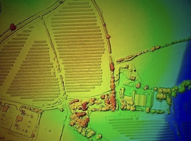
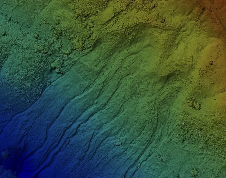
Team UAV Live shows the drone's position, the feeds coming from the drone, an interactive map of the area around the drone, a live chat screen from all key stakeholders. As well as all of this information, there is a repository for viewing and downloading images, videos and other datasets.
Get in touch with our teams now to find out how Team UAV Live can help your operations

%20copy%202.png)
GET STEPS
AHEAD
When it's just not possible for you or your team to get out or close to the asset or situation, our experienced Pilots will stream the data to you so you can make informed decisions
%20copy%202.png)
INSTANT
REPLAY
Our instant replay controls give you the chance to look over your data on the fly.. increasing the confidence in your decision making process and aiding mission success
%20copy%202.png)
CONCURRENT
MULTI-USERS
Need a second pair of eyes? No problem, add as many people as you need, wherever they are, whatever networked or WiFi mobile / tablet / Mac or PC device they are using